Dorado night lights from space
Night Light of Dorado from space (Puerto Rico) Src. Average luminocity for 10x10km area is 56.4607% and for 50x50km: 32.5149%.
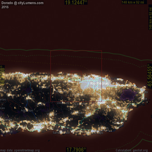
Analysis of Dorado night lights 2016
Square area 10x10 km:
 5.99%
5.99%90-99
10.54%80-89
14.88%70-79
9.92%60-69
11.57%50-59
8.26%40-49
3.31%30-39
3.1%20-29
13.43%10-19
17.77%0-9
1.24%Square area 50x50 km:
8.56%90-99
4.68%80-89
4.36%70-79
4.37%60-69
5.76%50-59
3.4%40-49
4.13%30-39
4.85%20-29
7.57%10-19
8.08%0-9
44.25%Clear (daylight) street map image can be seen on geolist.org.
Map coordinates:
19° 7' 28.1" North, 66° 58' 14.9" West
18° 27' 31.8" North, 66° 16' 3.6" West
17° 47' 26.2" North, 65° 33' 52.4" West
Some cities around Dorado sort by population:
• Candelaria
8.7 km =5.4 mi,  134°
134°
• Vega Alta
8.5 km =5.3 mi,  232°
232°
• Campanilla
5.3 km =3.3 mi,  142°
142°
• San Antonio
3.9 km =2.4 mi,  253°
253°
• Candelaria Arenas
7 km =4.3 mi, 131°
• Ingenio
4.8 km =3 mi,  112°
112°
• Toa Alta
8.1 km =5 mi,  165°
165°
• Toa Baja
1.9 km =1.2 mi,  152°
152°
4564133 (p: 13,117)
Sources (retrieved 2019-11-25):
» Earth at Night: Flat Maps 2012, 2016