Cidra night lights from space
Night Light of Cidra from space (Puerto Rico) Src. Average luminocity for 10x10km area is 46.2662% and for 50x50km: 41.3919%.
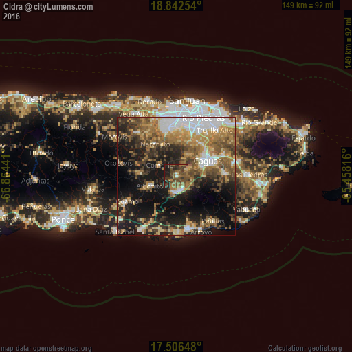
Analysis of Cidra night lights 2016
Square area 10x10 km:
 0.87%
0.87%90-99
2.6%80-89
2.6%70-79
3.25%60-69
17.53%50-59
16.23%40-49
19.05%30-39
16.88%20-29
10.17%10-19
10.82%0-9
0%Square area 50x50 km:
7.03%90-99
4.72%80-89
5.14%70-79
5.75%60-69
8.91%50-59
6.9%40-49
7.11%30-39
7.86%20-29
8.93%10-19
19.51%0-9
18.14%Clear (daylight) street map image can be seen on geolist.org.
Map coordinates:
18° 50' 33.1" North, 66° 51' 51.9" West
18° 10' 32.8" North, 66° 9' 40.6" West
17° 30' 23.3" North, 65° 27' 29.4" West
Some cities around Cidra sort by population:
• Caguas
13.6 km =8.5 mi,  61°
61°
• Guaynabo
20.9 km =13 mi,  14°
14°
• Cayey
7.1 km =4.4 mi,  184°
184°
• Aibonito
11.8 km =7.3 mi,  250°
250°
• Comerío
8.3 km =5.2 mi,  304°
304°
• Aguas Buenas
10.9 km =6.8 mi,  34°
34°
• Barranquitas
15.4 km =9.6 mi,  274°
274°
• Naranjito
16.5 km =10.3 mi,  327°
327°
4563777 (p: 5,067)
Sources (retrieved 2019-11-25):
» Earth at Night: Flat Maps 2012, 2016