Caguas night lights from space
Night Light of Caguas from space (Puerto Rico) Src. Average luminocity for 10x10km area is 77.8074% and for 50x50km: 49.0604%.
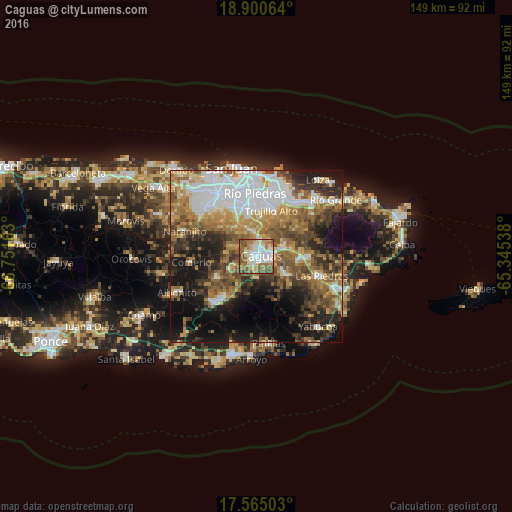
Analysis of Caguas night lights 2016
Square area 10x10 km:
 18.61%
90-99
21.43%80-89
12.12%70-79
6.28%60-69
17.1%50-59
14.5%40-49
9.31%30-39
0.65%20-29
0%10-19
0%0-9
0%Square area 50x50 km:
11.27%90-99
6.96%80-89
5.4%70-79
6.42%60-69
9.65%50-59
8.24%40-49
8.21%30-39
7.36%20-29
8.33%10-19
14.94%0-9
13.22%Clear (daylight) street map image can be seen on geolist.org.
Map coordinates:
18° 54' 2.3" North, 66° 45' 5.9" West
18° 14' 2.8" North, 66° 2' 54.6" West
17° 33' 54.1" North, 65° 20' 43.4" West
Some cities around Caguas sort by population:
• Guaynabo
15.2 km =9.4 mi,  334°
334°
• Trujillo Alto
14.1 km =8.8 mi,  17°
17°
• Cayey
18.4 km =11.4 mi,  222°
222°
• San Lorenzo
10.5 km =6.5 mi,  118°
118°
• Gurabo
8.3 km =5.2 mi,  74°
74°
• Juncos
13.5 km =8.4 mi,  93°
93°
• Cidra
13.6 km =8.5 mi,  241°
241°
• Aguas Buenas
6.3 km =3.9 mi,  293°
293°
4563008 (p: 86,804)
Sources (retrieved 2019-11-25):
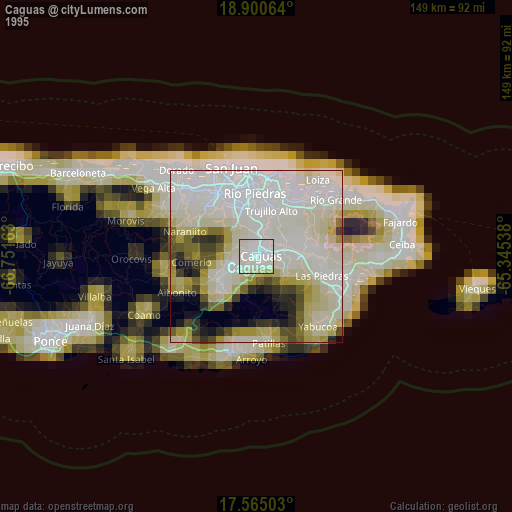
» NASA, Earths city lights 1995
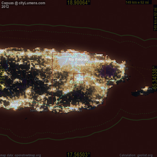
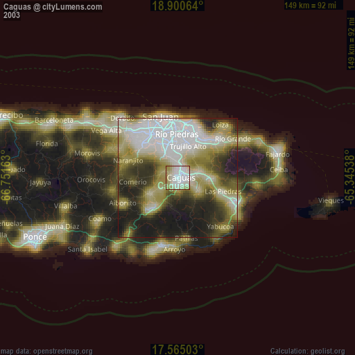
» NASA city lights 2003
» Earth at Night: Flat Maps 2012, 2016