Barranquitas night lights from space
Night Light of Barranquitas from space (Puerto Rico) Src. Average luminocity for 10x10km area is 25.3874% and for 50x50km: 35.2873%.
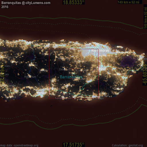
Analysis of Barranquitas night lights 2016
Square area 10x10 km:
 0.43%
0.43%90-99
1.08%80-89
1.73%70-79
2.6%60-69
4.11%50-59
3.68%40-49
4.11%30-39
12.34%20-29
11.9%10-19
44.37%0-9
13.64%Square area 50x50 km:
5.07%90-99
3.21%80-89
4.89%70-79
4.64%60-69
7.04%50-59
5%40-49
6.02%30-39
8.61%20-29
11.6%10-19
21.27%0-9
22.65%Clear (daylight) street map image can be seen on geolist.org.
Map coordinates:
18° 51' 12" North, 67° 0' 33.9" West
18° 11' 11.8" North, 66° 18' 22.6" West
17° 31' 2.5" North, 65° 36' 11.4" West
Some cities around Barranquitas sort by population:
• Cayey
17 km =10.6 mi,  119°
119°
• Coamo
13.1 km =8.1 mi,  204°
204°
• Corozal
17.2 km =10.7 mi,  356°
356°
• Aibonito
6.7 km =4.2 mi,  140°
140°
• Cidra
15.4 km =9.6 mi,  94°
94°
• Comerío
9.2 km =5.7 mi,  67°
67°
• Naranjito
14.3 km =8.9 mi,  27°
27°
• Orocovis
10 km =6.2 mi,  296°
296°
4562778 (p: 3,021)
Sources (retrieved 2019-11-25):
» Earth at Night: Flat Maps 2012, 2016