Żory night lights from space
Night Light of Żory (Silesia) from space (Poland) Src. Average luminocity for 10x10km area is 33.5098% and for 50x50km: 26.7192%.
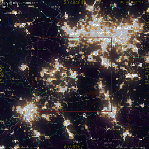
Analysis of Żory night lights 2016
Square area 10x10 km:
 5.46%
5.46%90-99
6.3%80-89
1.4%70-79
3.64%60-69
5.74%50-59
2.94%40-49
2.38%30-39
5.74%20-29
19.05%10-19
28.43%0-9
18.91%Square area 50x50 km:
4.56%90-99
4.93%80-89
1.61%70-79
2.35%60-69
3.34%50-59
3.58%40-49
4.42%30-39
5.7%20-29
10.95%10-19
18.27%0-9
40.3%Clear (daylight) street map image can be seen on geolist.org.
Map coordinates:
50° 29' 40.7" North, 17° 59' 51" East
50° 2' 42.8" North, 18° 42' 2.2" East
49° 35' 29.7" North, 19° 24' 13.5" East
Some cities around Żory sort by population:
• Rybnik
12.7 km =7.9 mi,  296°
296°
• Jastrzębie Zdrój
13.4 km =8.3 mi,  222°
222°
• Czerwionka-Leszczyny
11.8 km =7.3 mi,  351°
351°
• Łaziska Górne
15.4 km =9.6 mi,  41°
41°
• Orzesze
13.5 km =8.4 mi,  24°
24°
• Niedobczyce
14.8 km =9.2 mi,  278°
278°
• Pawłowice
9.4 km =5.8 mi,  172°
172°
• Markłowice
13.2 km =8.2 mi,  256°
256°
3080004 (p: 63,174)
Sources (retrieved 2019-11-25):
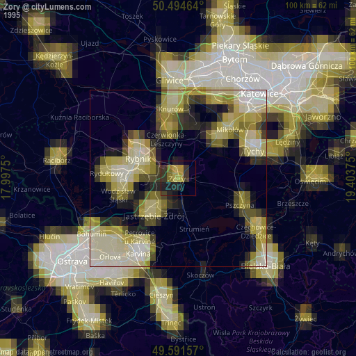
» NASA, Earths city lights 1995
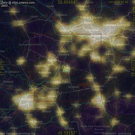
» NASA city lights 2003
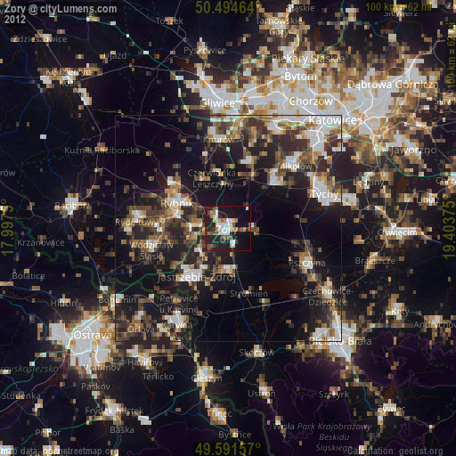
» Earth at Night: Flat Maps 2012, 2016