Rybnik night lights from space
Night Light of Rybnik (Silesia) from space (Poland) Src. Average luminocity for 10x10km area is 50.8936% and for 50x50km: 22.5176%.
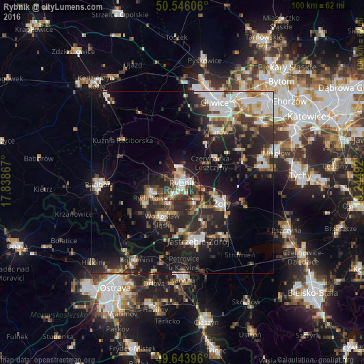
Analysis of Rybnik night lights 2016
Square area 10x10 km:
 10.36%
90-99
10.92%80-89
4.06%70-79
5.46%60-69
5.18%50-59
7.14%40-49
12.75%30-39
7.56%20-29
18.91%10-19
16.67%0-9
0.98%Square area 50x50 km:
3.95%90-99
4.35%80-89
1.39%70-79
2.17%60-69
2.7%50-59
2.72%40-49
3.53%30-39
4.01%20-29
8.76%10-19
15.49%0-9
50.93%Clear (daylight) street map image can be seen on geolist.org.
Map coordinates:
50° 32' 45.8" North, 17° 50' 19.2" East
50° 5' 49.7" North, 18° 32' 30.4" East
49° 38' 38.3" North, 19° 14' 41.7" East
Some cities around Rybnik sort by population:
• Żory
12.7 km =7.9 mi,  116°
116°
• Wodzisław Śląski
11.5 km =7.1 mi,  205°
205°
• Czerwionka-Leszczyny
11.3 km =7 mi,  58°
58°
• Rydułtowy
9.9 km =6.2 mi,  244°
244°
• Radlin
7 km =4.3 mi,  221°
221°
• Pszów
12.3 km =7.6 mi, 238°
• Niedobczyce
4.8 km =3 mi, 223°
• Markłowice
9 km =5.6 mi,  189°
189°
3086586 (p: 142,510)
Sources (retrieved 2019-11-25):
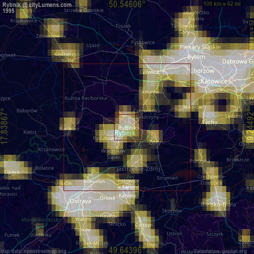
» NASA, Earths city lights 1995
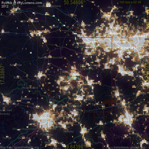
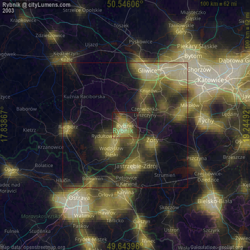
» NASA city lights 2003
» Earth at Night: Flat Maps 2012, 2016