Jastrzębie Zdrój night lights from space
Night Light of Jastrzębie Zdrój (Silesia) from space (Poland) Src. Average luminocity for 10x10km area is 41.2633% and for 50x50km: 22.237%.
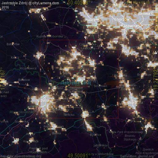
Analysis of Jastrzębie Zdrój night lights 2016
Square area 10x10 km:
 9.1%
9.1%90-99
8.26%80-89
1.12%70-79
3.5%60-69
4.06%50-59
5.74%40-49
5.18%30-39
5.04%20-29
26.05%10-19
31.51%0-9
0.42%Square area 50x50 km:
3.38%90-99
3.62%80-89
1.56%70-79
2.27%60-69
2.66%50-59
2.91%40-49
3.92%30-39
3.55%20-29
8.97%10-19
18.56%0-9
48.59%Clear (daylight) street map image can be seen on geolist.org.
Map coordinates:
50° 24' 20.4" North, 17° 52' 18" East
49° 57' 19.5" North, 18° 34' 29.2" East
49° 30' 3.3" North, 19° 16' 40.5" East
Some cities around Jastrzębie Zdrój sort by population:
• Karviná, CZ
11.5 km =7.1 mi,  191°
191°
• Żory
13.4 km =8.3 mi,  42°
42°
• Wodzisław Śląski
9.1 km =5.7 mi,  306°
306°
• Radlin
12.7 km =7.9 mi,  326°
326°
• Niedobczyce
13.5 km =8.4 mi,  335°
335°
• Pawłowice
10.2 km =6.3 mi,  86°
86°
• Markłowice
7.8 km =4.8 mi, 330°
• Zebrzydowice
9 km =5.6 mi,  163°
163°
3097391 (p: 95,813)
Sources (retrieved 2019-11-25):
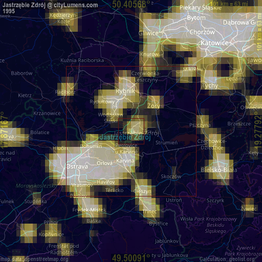
» NASA, Earths city lights 1995
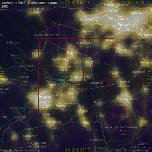
» NASA city lights 2003
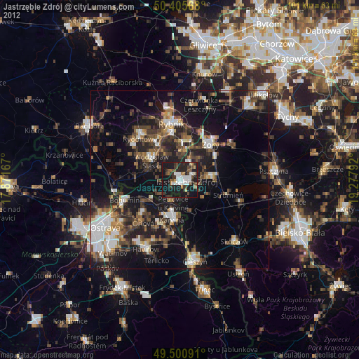
» Earth at Night: Flat Maps 2012, 2016