Ursynów night lights from space
Night Light of Ursynów (Mazovia) from space (Poland) Src. Average luminocity for 10x10km area is 86.6495% and for 50x50km: 40.2933%.
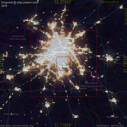
Analysis of Ursynów night lights 2016
Square area 10x10 km:
 42.33%
90-99
22.35%80-89
3.84%70-79
9.52%60-69
9.92%50-59
5.03%40-49
5.42%30-39
1.59%20-29
0%10-19
0%0-9
0%Square area 50x50 km:
13.56%90-99
8.69%80-89
3.46%70-79
3.55%60-69
4.15%50-59
4.25%40-49
4.32%30-39
4.86%20-29
7.85%10-19
9.82%0-9
35.49%Clear (daylight) street map image can be seen on geolist.org.
Map coordinates:
52° 34' 47.5" North, 20° 20' 50.2" East
52° 9' 1.8" North, 21° 3' 1.5" East
51° 43' 1.2" North, 21° 45' 12.7" East
Some cities around Ursynów sort by population:
• Mokotów
4.9 km =3 mi,  347°
347°
• Ochota
9 km =5.6 mi,  330°
330°
• Piaseczno
7.9 km =4.9 mi,  193°
193°
• Włochy
7.8 km =4.8 mi,  294°
294°
• Kabaty
3.1 km =1.9 mi,  136°
136°
• Konstancin-Jeziorna
7.8 km =4.8 mi, 143°
• Wilanów
2.9 km =1.8 mi,  61°
61°
• Raszyn
8.7 km =5.4 mi,  274°
274°
6545326 (p: 147,676)
Sources (retrieved 2019-11-25):
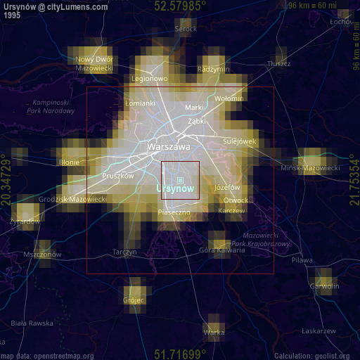
» NASA, Earths city lights 1995
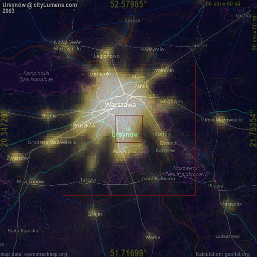
» NASA city lights 2003
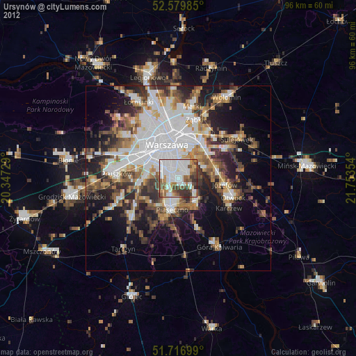
» Earth at Night: Flat Maps 2012, 2016