Strzałkowo night lights from space
Night Light of Strzałkowo (Greater Poland) from space (Poland) Src. Average luminocity for 10x10km area is 8.5051% and for 50x50km: 2.9344%.
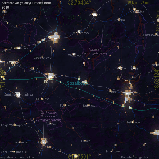
Analysis of Strzałkowo night lights 2016
Square area 10x10 km:
 1.01%
1.01%90-99
1.26%80-89
1.39%70-79
0.88%60-69
1.77%50-59
1.26%40-49
0.25%30-39
1.01%20-29
0.38%10-19
1.26%0-9
89.52%Square area 50x50 km:
0.33%90-99
0.45%80-89
0.32%70-79
0.38%60-69
0.43%50-59
0.33%40-49
0.39%30-39
0.28%20-29
0.33%10-19
2.15%0-9
94.61%Clear (daylight) street map image can be seen on geolist.org.
Map coordinates:
52° 44' 5.4" North, 17° 6' 54" East
52° 18' 25.2" North, 17° 49' 5.2" East
51° 52' 30" North, 18° 31' 16.5" East
Some cities around Strzałkowo sort by population:
• Konin
30.9 km =19.2 mi,  107°
107°
• Gniezno
29.9 km =18.6 mi,  327°
327°
• Września
17.3 km =10.7 mi,  276°
276°
• Środa Wielkopolska
37.9 km =23.5 mi,  256°
256°
• Słupca
4.3 km =2.7 mi,  120°
120°
• Mogilno
40.1 km =24.9 mi,  13°
13°
• Trzemeszno
28.3 km =17.6 mi,  0°
0°
• Witkowo
15.1 km =9.4 mi,  348°
348°
3084449 (p: 5,140)
Sources (retrieved 2019-11-25):
» Earth at Night: Flat Maps 2012, 2016