Konin night lights from space
Night Light of Konin (Greater Poland) from space (Poland) Src. Average luminocity for 10x10km area is 33.0714% and for 50x50km: 3.8115%.
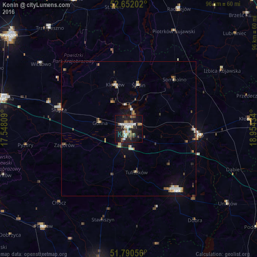
Analysis of Konin night lights 2016
Square area 10x10 km:
 6.75%
6.75%90-99
6.75%80-89
1.32%70-79
2.91%60-69
5.03%50-59
4.63%40-49
3.17%30-39
2.12%20-29
10.45%10-19
34.79%0-9
22.09%Square area 50x50 km:
0.52%90-99
0.57%80-89
0.35%70-79
0.46%60-69
0.43%50-59
0.58%40-49
0.48%30-39
0.45%20-29
0.6%10-19
2.95%0-9
92.6%Clear (daylight) street map image can be seen on geolist.org.
Map coordinates:
52° 39' 7.3" North, 17° 32' 53.1" East
52° 13' 24.2" North, 18° 15' 4.4" East
51° 47' 26" North, 18° 57' 15.6" East
Some cities around Konin sort by population:
• Turek
28.7 km =17.8 mi,  143°
143°
• Koło
26.5 km =16.5 mi,  95°
95°
• Słupca
26.8 km =16.7 mi,  285°
285°
• Witkowo
40.4 km =25.1 mi,  306°
306°
• Kłodawa
45.2 km =28.1 mi,  85°
85°
• Strzelno
45.3 km =28.1 mi,  353°
353°
• Strzałkowo
30.9 km =19.2 mi, 287°
• Piotrków Kujawski
40.1 km =24.9 mi,  24°
24°
3095321 (p: 81,258)
Sources (retrieved 2019-11-25):
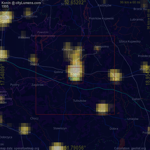
» NASA, Earths city lights 1995
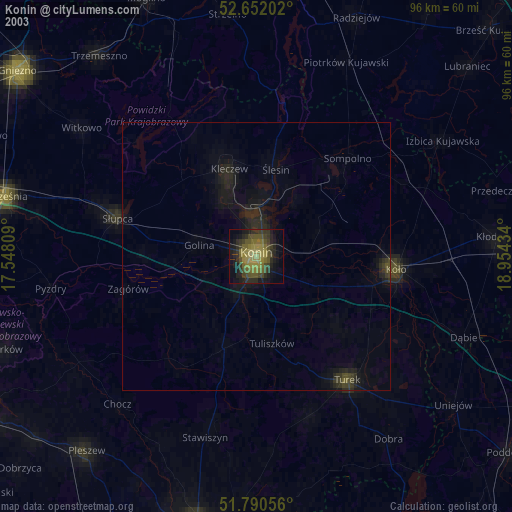
» NASA city lights 2003
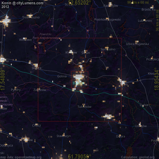
» Earth at Night: Flat Maps 2012, 2016