Sierpc night lights from space
Night Light of Sierpc (Mazovia) from space (Poland) Src. Average luminocity for 10x10km area is 10.1907% and for 50x50km: 1.196%.
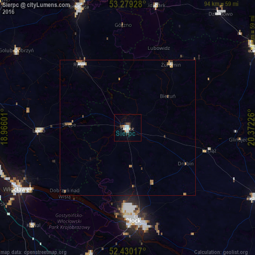
Analysis of Sierpc night lights 2016
Square area 10x10 km:
 2.65%
2.65%90-99
1.89%80-89
0.63%70-79
0.38%60-69
0.51%50-59
1.01%40-49
1.64%30-39
1.39%20-29
1.01%10-19
1.01%0-9
87.88%Square area 50x50 km:
0.17%90-99
0.14%80-89
0.05%70-79
0.23%60-69
0.27%50-59
0.14%40-49
0.15%30-39
0.18%20-29
0.08%10-19
0.26%0-9
98.32%Clear (daylight) street map image can be seen on geolist.org.
Map coordinates:
53° 16' 45.4" North, 18° 57' 57.6" East
52° 51' 24.5" North, 19° 40' 8.9" East
52° 25' 48.6" North, 20° 22' 20.1" East
Some cities around Sierpc sort by population:
• Płock
34.6 km =21.5 mi,  175°
175°
• Włocławek
46.6 km =29 mi,  240°
240°
• Brodnica
48.4 km =30.1 mi,  337°
337°
• Gostynin
49.5 km =30.8 mi,  196°
196°
• Rypin
29 km =18 mi,  323°
323°
• Lipno
33 km =20.5 mi,  267°
267°
• Żuromin
28.3 km =17.6 mi,  34°
34°
• Lidzbark
46.4 km =28.8 mi,  13°
13°
3085941 (p: 18,866)
Sources (retrieved 2019-11-25):
» Earth at Night: Flat Maps 2012, 2016