Sandomierz night lights from space
Night Light of Sandomierz (Świętokrzyskie) from space (Poland) Src. Average luminocity for 10x10km area is 20.8596% and for 50x50km: 3.7467%.
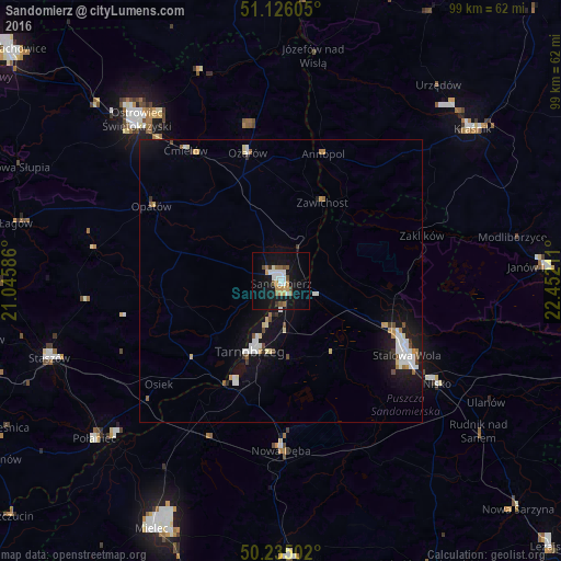

Analysis of Sandomierz night lights 2016
Square area 10x10 km:
 3.21%
3.21%90-99
4.01%80-89
0.53%70-79
3.61%60-69
2.94%50-59
2.27%40-49
2.41%30-39
1.07%20-29
0%10-19
27.81%0-9
52.14%Square area 50x50 km:
0.68%90-99
0.76%80-89
0.32%70-79
0.38%60-69
0.35%50-59
0.31%40-49
0.33%30-39
0.26%20-29
0.23%10-19
4.01%0-9
92.36%Clear (daylight) street map image can be seen on geolist.org.
Map coordinates:
51° 7' 33.8" North, 21° 2' 45.1" East
50° 40' 57.5" North, 21° 44' 56.3" East
50° 14' 6.1" North, 22° 27' 7.6" East
Some cities around Sandomierz sort by population:
• Ostrowiec Świętokrzyski
37.5 km =23.3 mi,  317°
317°
• Stalowa Wola
24.2 km =15 mi,  117°
117°
• Tarnobrzeg
13.1 km =8.1 mi,  201°
201°
• Kraśnik
43 km =26.7 mi,  51°
51°
• Nisko
33 km =20.5 mi, 123°
• Nowa Dęba
28.1 km =17.5 mi,  179°
179°
• Gorzyce
6.6 km =4.1 mi,  104°
104°
• Opatów
26.3 km =16.3 mi,  299°
299°
759603 (p: 25,087)
Sources (retrieved 2019-11-25):
» Earth at Night: Flat Maps 2012, 2016