Ostrowiec Świętokrzyski night lights from space
Night Light of Ostrowiec Świętokrzyski (Świętokrzyskie) from space (Poland) Src. Average luminocity for 10x10km area is 35.7255% and for 50x50km: 3.3577%.
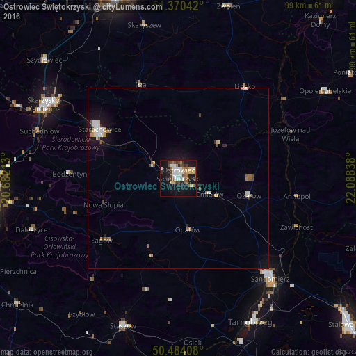
Analysis of Ostrowiec Świętokrzyski night lights 2016
Square area 10x10 km:
 7.28%
7.28%90-99
6.44%80-89
4.06%70-79
2.94%60-69
6.02%50-59
3.36%40-49
6.72%30-39
3.22%20-29
3.78%10-19
33.05%0-9
23.11%Square area 50x50 km:
0.52%90-99
0.6%80-89
0.33%70-79
0.34%60-69
0.42%50-59
0.44%40-49
0.46%30-39
0.26%20-29
0.27%10-19
3.11%0-9
93.25%Clear (daylight) street map image can be seen on geolist.org.
Map coordinates:
51° 22' 13.5" North, 20° 40' 55.7" East
50° 55' 45.7" North, 21° 23' 6.9" East
50° 29' 2.7" North, 22° 5' 18.2" East
Some cities around Ostrowiec Świętokrzyski sort by population:
• Starachowice
25 km =15.5 mi,  298°
298°
• Skarżysko-Kamienna
41.3 km =25.7 mi, 299°
• Sandomierz
37.5 km =23.3 mi,  137°
137°
• Suchedniów
41.1 km =25.5 mi,  288°
288°
• Gorzyce
43.3 km =26.9 mi,  132°
132°
• Opatów
14.6 km =9.1 mi,  168°
168°
• Lipsko
31.6 km =19.6 mi,  35°
35°
• Iłża
27.9 km =17.3 mi,  338°
338°
762863 (p: 73,989)
Sources (retrieved 2019-11-25):
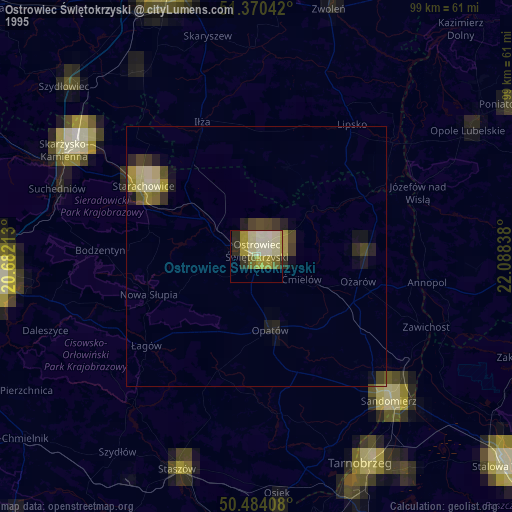
» NASA, Earths city lights 1995
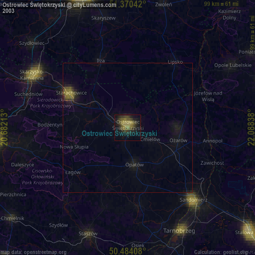
» NASA city lights 2003
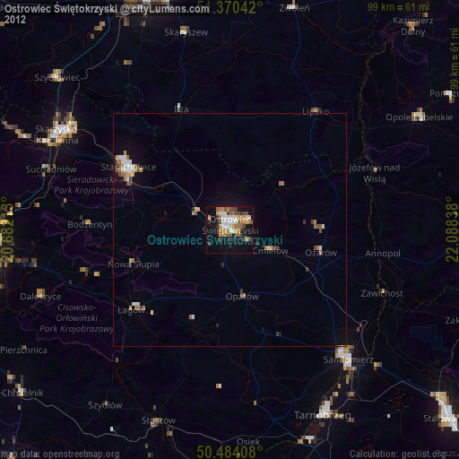
» Earth at Night: Flat Maps 2012, 2016