Rejon ulicy Traugutta night lights from space
Night Light of Rejon ulicy Traugutta (Lower Silesia) from space (Poland) Src. Average luminocity for 10x10km area is 90.6725% and for 50x50km: 16.5966%.
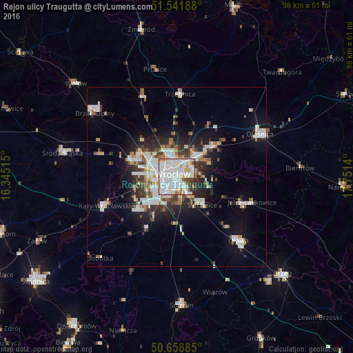
Analysis of Rejon ulicy Traugutta night lights 2016
Square area 10x10 km:
 43.98%
90-99
33.02%80-89
7.09%70-79
4.68%60-69
1.74%50-59
2.01%40-49
2.67%30-39
3.88%20-29
0.94%10-19
0%0-9
0%Square area 50x50 km:
4.29%90-99
3.94%80-89
1.18%70-79
1.27%60-69
1.44%50-59
1.58%40-49
1.77%30-39
2.13%20-29
3.7%10-19
7.96%0-9
70.77%Clear (daylight) street map image can be seen on geolist.org.
Map coordinates:
51° 32' 30.8" North, 16° 20' 42.5" East
51° 6' 8.9" North, 17° 2' 53.8" East
50° 39' 31.9" North, 17° 45' 5" East
Some cities around Rejon ulicy Traugutta sort by population:
• Wrocław
1.1 km =0.7 mi,  255°
255°
• Karłowice
4.3 km =2.7 mi,  3°
3°
• Powstańców Śląskich Zachód-Centrum Południow
2.3 km =1.4 mi,  251°
251°
• Powstańców Śląskich Wschód
2 km =1.2 mi,  233°
233°
• Biskupin
3.9 km =2.4 mi,  92°
92°
• Sępolno
3.8 km =2.4 mi,  77°
77°
• Księże Małe-Księże Wielkie
4.3 km =2.7 mi,  139°
139°
• Osiedle Henrykowskie
1.4 km =0.9 mi,  166°
166°
12047628 (p: 20,617)
Sources (retrieved 2019-11-25):
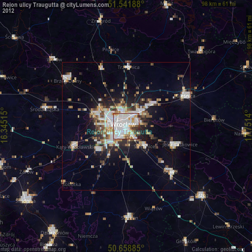
» Earth at Night: Flat Maps 2012, 2016