Sępolno night lights from space
Night Light of Sępolno (Lower Silesia) from space (Poland) Src. Average luminocity for 10x10km area is 68.8422% and for 50x50km: 16.1158%.
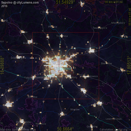
Analysis of Sępolno night lights 2016
Square area 10x10 km:
 23.4%
23.4%90-99
22.06%80-89
6.28%70-79
5.48%60-69
3.61%50-59
3.21%40-49
7.09%30-39
9.89%20-29
12.97%10-19
6.02%0-9
0%Square area 50x50 km:
4.17%90-99
3.81%80-89
1.17%70-79
1.18%60-69
1.39%50-59
1.52%40-49
1.7%30-39
2.1%20-29
3.67%10-19
7.92%0-9
71.37%Clear (daylight) street map image can be seen on geolist.org.
Map coordinates:
51° 32' 57.4" North, 16° 23' 56" East
51° 6' 35.8" North, 17° 6' 7.2" East
50° 39' 59" North, 17° 48' 18.5" East
Some cities around Sępolno sort by population:
• Rejon placu Świętego Macieja
4.6 km =2.9 mi,  284°
284°
• Rejon placu Grunwaldzkiego
2.9 km =1.8 mi, 284°
• Rejon ulicy Traugutta
3.8 km =2.4 mi,  257°
257°
• Zgorzelisko
3.9 km =2.4 mi,  34°
34°
• Biskupin
1 km =0.6 mi,  170°
170°
• Księże Małe-Księże Wielkie
4.2 km =2.6 mi,  192°
192°
• Osiedle Henrykowskie
4.1 km =2.5 mi,  237°
237°
• Psie Pole Południe-Kiełczów
4.6 km =2.9 mi,  22°
22°
12047620 (p: 7,724)
Sources (retrieved 2019-11-25):
» Earth at Night: Flat Maps 2012, 2016