Wrocław night lights from space
Night Light of Wrocław (Lower Silesia) from space (Poland) Src. Average luminocity for 10x10km area is 93.242% and for 50x50km: 16.463%.
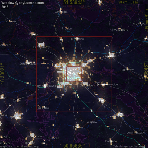
Analysis of Wrocław night lights 2016
Square area 10x10 km:
 47.73%
90-99
33.02%80-89
6.68%70-79
4.81%60-69
2.01%50-59
2.14%40-49
3.07%30-39
0.53%20-29
0%10-19
0%0-9
0%Square area 50x50 km:
4.24%90-99
3.87%80-89
1.17%70-79
1.27%60-69
1.44%50-59
1.58%40-49
1.77%30-39
2.13%20-29
3.69%10-19
7.78%0-9
71.08%Clear (daylight) street map image can be seen on geolist.org.
Map coordinates:
51° 32' 21.9" North, 16° 19' 48.8" East
51° 6' 0" North, 17° 1' 60" East
50° 39' 22.9" North, 17° 44' 11.3" East
Some cities around Wrocław sort by population:
• Rejon placu Świętego Macieja
2.3 km =1.4 mi,  7°
7°
• Rejon placu Grunwaldzkiego
2.7 km =1.7 mi,  46°
46°
• Rejon ulicy Traugutta
1.1 km =0.7 mi,  75°
75°
• Powstańców Śląskich Zachód-Centrum Południow
1.2 km =0.7 mi,  248°
248°
• Powstańców Śląskich Wschód
1.1 km =0.7 mi,  212°
212°
• Rejon ulicy Mieleckiej
2.4 km =1.5 mi, 246°
• Rejon ulicy Klęczkowskiej
3.3 km =2.1 mi,  0°
0°
• Osiedle Henrykowskie
1.8 km =1.1 mi,  129°
129°
3081368 (p: 634,893)
Sources (retrieved 2019-11-25):
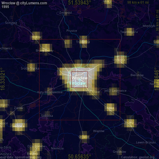
» NASA, Earths city lights 1995
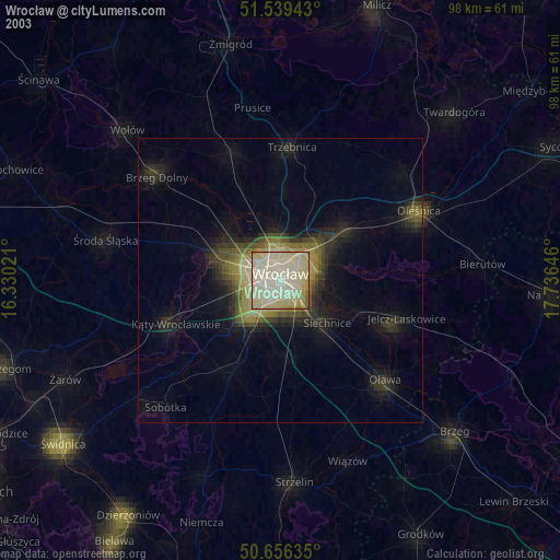
» NASA city lights 2003
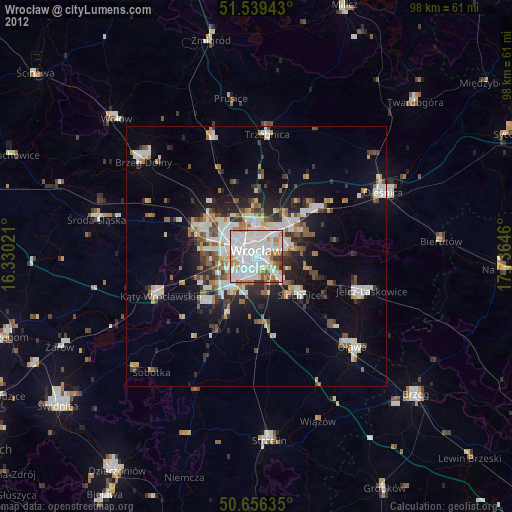
» Earth at Night: Flat Maps 2012, 2016