Powstańców Śląskich Wschód night lights from space
Night Light of Powstańców Śląskich Wschód (Lower Silesia) from space (Poland) Src. Average luminocity for 10x10km area is 92.0013% and for 50x50km: 16.3517%.
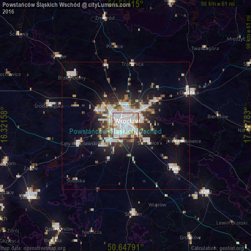
Analysis of Powstańców Śląskich Wschód night lights 2016
Square area 10x10 km:
 46.39%
90-99
32.35%80-89
5.75%70-79
4.95%60-69
3.21%50-59
2.41%40-49
3.21%30-39
1.34%20-29
0.4%10-19
0%0-9
0%Square area 50x50 km:
4.22%90-99
3.84%80-89
1.16%70-79
1.24%60-69
1.41%50-59
1.57%40-49
1.79%30-39
2.15%20-29
3.67%10-19
7.7%0-9
71.26%Clear (daylight) street map image can be seen on geolist.org.
Map coordinates:
51° 31' 52.1" North, 16° 19' 17.7" East
51° 5' 29.9" North, 17° 1' 28.9" East
50° 38' 52.5" North, 17° 43' 40.2" East
Some cities around Powstańców Śląskich Wschód sort by population:
• Wrocław
1.1 km =0.7 mi,  32°
32°
• Rejon placu Świętego Macieja
3.3 km =2.1 mi,  15°
15°
• Rejon placu Grunwaldzkiego
3.8 km =2.4 mi,  42°
42°
• Rejon ulicy Traugutta
2 km =1.2 mi,  53°
53°
• Krzyki
3.1 km =1.9 mi,  222°
222°
• Grabiszynek
2.7 km =1.7 mi,  259°
259°
• Rejon ulicy Mieleckiej
1.6 km =1 mi,  269°
269°
• Osiedle Henrykowskie
2 km =1.2 mi,  95°
95°
12047662 (p: 11,456)
Sources (retrieved 2019-11-25):
» Earth at Night: Flat Maps 2012, 2016