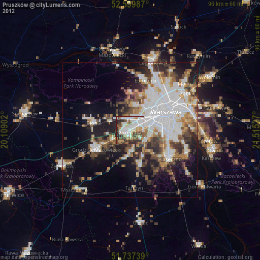
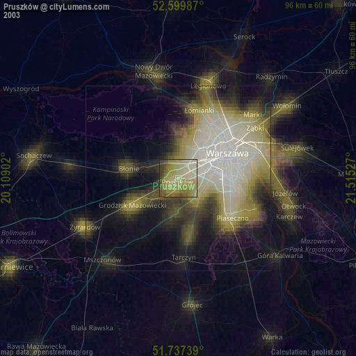
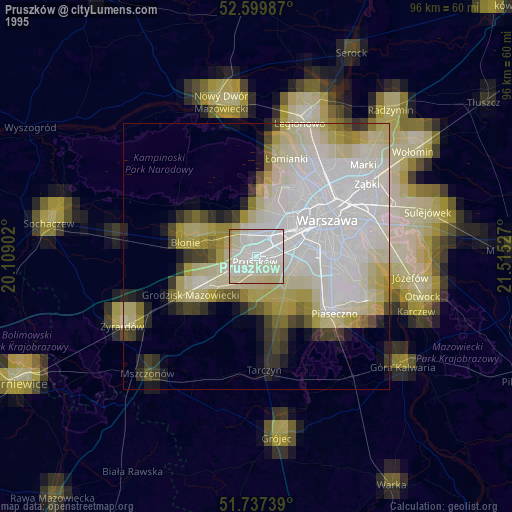
Pruszków night lights from space
Night Light of Pruszków (Mazovia) from space (Poland) Src. Average luminocity for 10x10km area is 81.4418% and for 50x50km: 38.5499%.
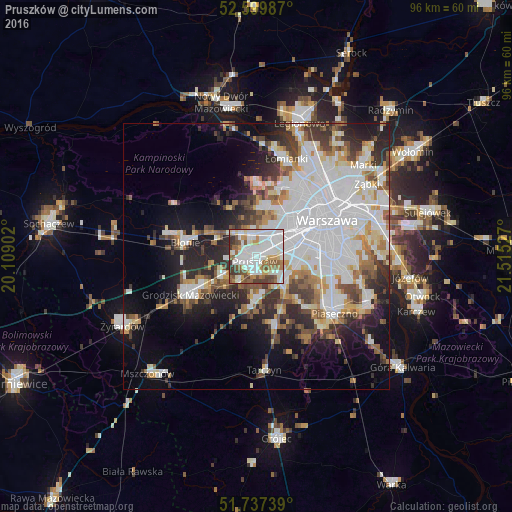
Analysis of Pruszków night lights 2016
Square area 10x10 km:
 29.37%
90-99
27.78%80-89
4.37%70-79
7.8%60-69
6.22%50-59
11.11%40-49
7.14%30-39
5.29%20-29
0.93%10-19
0%0-9
0%Square area 50x50 km:
13.42%90-99
8.51%80-89
3.05%70-79
3.14%60-69
4.03%50-59
3.78%40-49
3.86%30-39
4.36%20-29
6.96%10-19
10.18%0-9
38.71%Clear (daylight) street map image can be seen on geolist.org.
Map coordinates:
52° 35' 59.5" North, 20° 6' 32.5" East
52° 10' 14.6" North, 20° 48' 43.7" East
51° 44' 14.6" North, 21° 30' 55" East
Some cities around Pruszków sort by population:
• Ursus
5.6 km =3.5 mi,  61°
61°
• Włochy
9.2 km =5.7 mi,  83°
83°
• Piastów
2.4 km =1.5 mi,  50°
50°
• Brwinów
7.2 km =4.5 mi,  244°
244°
• Nadarzyn
8.5 km =5.3 mi,  182°
182°
• Ożarów Mazowiecki
4.5 km =2.8 mi,  346°
346°
• Raszyn
7.7 km =4.8 mi,  102°
102°
• Komorów
2.8 km =1.7 mi, 175°
761228 (p: 55,371)
Sources (retrieved 2019-11-25):
» NASA, Earths city lights 1995
» NASA city lights 2003
» Earth at Night: Flat Maps 2012, 2016