Czerwonak night lights from space
Night Light of Czerwonak (Greater Poland) from space (Poland) Src. Average luminocity for 10x10km area is 52.2929% and for 50x50km: 18.8718%.
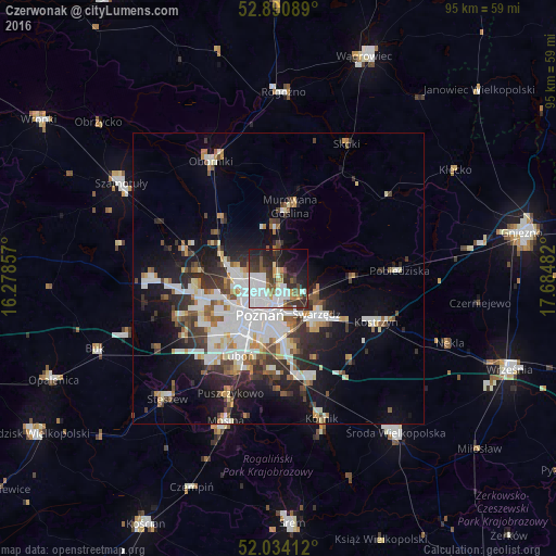
Analysis of Czerwonak night lights 2016
Square area 10x10 km:
 17.93%
90-99
13.01%80-89
1.26%70-79
3.66%60-69
3.91%50-59
6.06%40-49
4.55%30-39
11.11%20-29
15.4%10-19
15.03%0-9
8.08%Square area 50x50 km:
4.55%90-99
4.25%80-89
1.53%70-79
1.55%60-69
1.59%50-59
2.29%40-49
1.9%30-39
3.05%20-29
4.5%10-19
9.35%0-9
65.43%Clear (daylight) street map image can be seen on geolist.org.
Map coordinates:
52° 53' 27.2" North, 16° 16' 42.9" East
52° 27' 52.5" North, 16° 58' 54.1" East
52° 2' 2.8" North, 17° 41' 5.4" East
Some cities around Czerwonak sort by population:
• Poznań
7.3 km =4.5 mi,  208°
208°
• Swarzędz
9.1 km =5.7 mi,  129°
129°
• Luboń
14.4 km =8.9 mi,  204°
204°
• Murowana Goślina
12.4 km =7.7 mi,  8°
8°
• Kostrzyn
18.3 km =11.4 mi,  113°
113°
• Pobiedziska
20.8 km =12.9 mi,  86°
86°
• Plewiska
15.9 km =9.9 mi,  227°
227°
• Komorniki
18.2 km =11.3 mi,  219°
219°
3100971 (p: 5,432)
Sources (retrieved 2019-11-25):
» Earth at Night: Flat Maps 2012, 2016