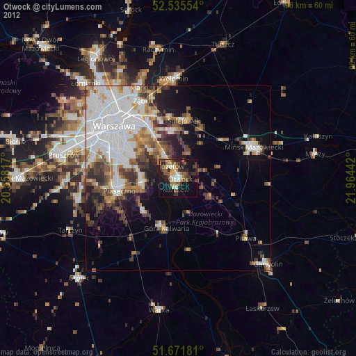
Otwock night lights from space
Night Light of Otwock (Mazovia) from space (Poland) Src. Average luminocity for 10x10km area is 35.3664% and for 50x50km: 29.1206%.
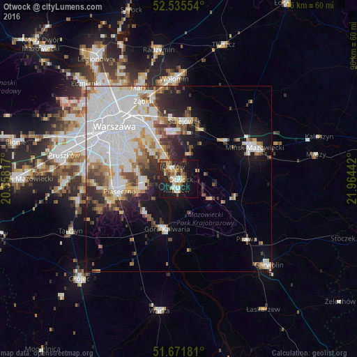
Analysis of Otwock night lights 2016
Square area 10x10 km:
 5.03%
5.03%90-99
6.08%80-89
5.56%70-79
4.89%60-69
2.78%50-59
4.89%40-49
4.37%30-39
3.04%20-29
13.62%10-19
30.29%0-9
19.44%Square area 50x50 km:
11.25%90-99
5.97%80-89
2.34%70-79
2.34%60-69
2.62%50-59
2.6%40-49
2.46%30-39
2.88%20-29
4.34%10-19
8.36%0-9
54.82%Clear (daylight) street map image can be seen on geolist.org.
Map coordinates:
52° 32' 7.9" North, 20° 33' 29.4" East
52° 6' 20.8" North, 21° 15' 40.6" East
51° 40' 18.5" North, 21° 57' 51.9" East
Some cities around Otwock sort by population:
• Ursynów
15.2 km =9.4 mi,  289°
289°
• Wawer
11.6 km =7.2 mi,  330°
330°
• Kabaty
12.6 km =7.8 mi,  282°
282°
• Józefów
3.9 km =2.4 mi, 333°
• Konstancin-Jeziorna
9.9 km =6.2 mi,  262°
262°
• Wilanów
13.5 km =8.4 mi,  298°
298°
• Góra Kalwaria
14.7 km =9.1 mi,  192°
192°
• Karczew
3.3 km =2.1 mi, 193°
762788 (p: 43,388)
Sources (retrieved 2019-11-25):
» Earth at Night: Flat Maps 2012, 2016