Józefów night lights from space
Night Light of Józefów (Mazovia) from space (Poland) Src. Average luminocity for 10x10km area is 43.7116% and for 50x50km: 32.9441%.
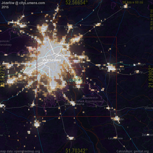
Analysis of Józefów night lights 2016
Square area 10x10 km:
 4.1%
4.1%90-99
6.08%80-89
8.2%70-79
7.54%60-69
4.37%50-59
6.22%40-49
7.14%30-39
7.14%20-29
24.21%10-19
24.34%0-9
0.66%Square area 50x50 km:
12.21%90-99
7.22%80-89
2.77%70-79
2.86%60-69
3.11%50-59
2.86%40-49
2.99%30-39
3.32%20-29
4.73%10-19
8.47%0-9
49.45%Clear (daylight) street map image can be seen on geolist.org.
Map coordinates:
52° 33' 59.5" North, 20° 31' 58" East
52° 8' 13.5" North, 21° 14' 9.2" East
51° 42' 12.3" North, 21° 56' 20.5" East
Some cities around Józefów sort by population:
• Ursynów
12.7 km =7.9 mi,  276°
276°
• Wawer
7.7 km =4.8 mi,  328°
328°
• Otwock
3.9 km =2.4 mi,  153°
153°
• Kabaty
10.6 km =6.6 mi,  265°
265°
• Sulejówek
13 km =8.1 mi,  10°
10°
• Konstancin-Jeziorna
9.4 km =5.8 mi,  239°
239°
• Wilanów
10.5 km =6.5 mi,  285°
285°
• Karczew
6.8 km =4.2 mi,  172°
172°
769981 (p: 17,910)
Sources (retrieved 2019-11-25):
» Earth at Night: Flat Maps 2012, 2016