Lubawa night lights from space
Night Light of Lubawa (Warmia-Masuria) from space (Poland) Src. Average luminocity for 10x10km area is 6.0926% and for 50x50km: 1.6609%.
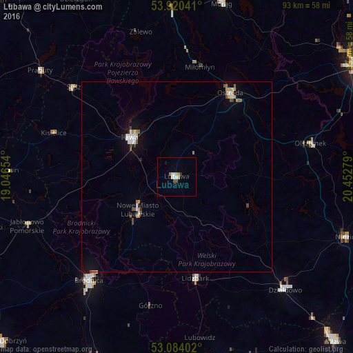
Analysis of Lubawa night lights 2016
Square area 10x10 km:
 1.19%
1.19%90-99
0.93%80-89
0.79%70-79
0.93%60-69
0.93%50-59
0.53%40-49
0.53%30-39
0.53%20-29
0%10-19
0.53%0-9
93.12%Square area 50x50 km:
0.25%90-99
0.3%80-89
0.12%70-79
0.25%60-69
0.14%50-59
0.21%40-49
0.28%30-39
0.06%20-29
0.05%10-19
0.77%0-9
97.58%Clear (daylight) street map image can be seen on geolist.org.
Map coordinates:
53° 55' 13.5" North, 19° 2' 47.5" East
53° 30' 15.4" North, 19° 44' 58.8" East
53° 5' 2.5" North, 20° 27' 10" East
Some cities around Lubawa sort by population:
• Ostróda
25.7 km =16 mi,  33°
33°
• Iława
15.7 km =9.8 mi,  310°
310°
• Brodnica
35.9 km =22.3 mi,  220°
220°
• Działdowo
40.5 km =25.2 mi,  136°
136°
• Nowe Miasto Lubawskie
13.8 km =8.6 mi,  227°
227°
• Lidzbark
27.3 km =17 mi,  169°
169°
• Olsztynek
36.4 km =22.6 mi,  75°
75°
• Susz
36.1 km =22.4 mi, 311°
3093028 (p: 9,302)
Sources (retrieved 2019-11-25):
» Earth at Night: Flat Maps 2012, 2016