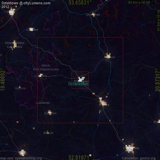
Działdowo night lights from space
Night Light of Działdowo (Warmia-Masuria) from space (Poland) Src. Average luminocity for 10x10km area is 8.2753% and for 50x50km: 1.6889%.
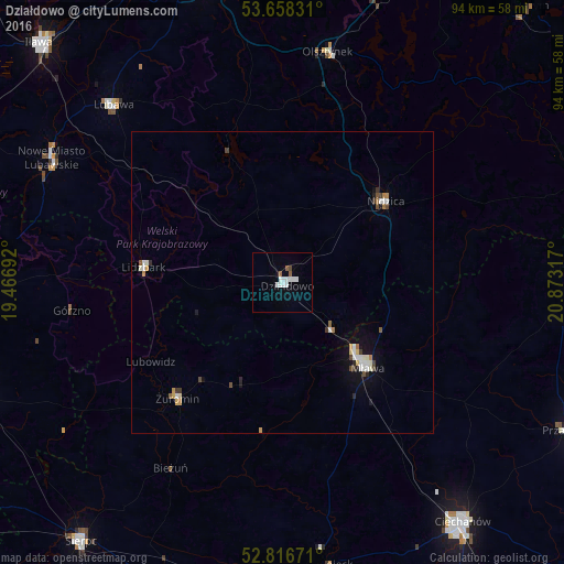
Analysis of Działdowo night lights 2016
Square area 10x10 km:
 2.27%
2.27%90-99
2.78%80-89
0%70-79
0%60-69
0%50-59
1.52%40-49
0.51%30-39
0%20-29
0%10-19
0.76%0-9
92.17%Square area 50x50 km:
0.29%90-99
0.4%80-89
0.1%70-79
0.17%60-69
0.14%50-59
0.17%40-49
0.22%30-39
0.15%20-29
0.14%10-19
0.7%0-9
97.52%Clear (daylight) street map image can be seen on geolist.org.
Map coordinates:
53° 39' 29.9" North, 19° 28' 0.9" East
53° 14' 22.5" North, 20° 10' 12.1" East
52° 49' 0.2" North, 20° 52' 23.4" East
Some cities around Działdowo sort by population:
• Ciechanów
49.9 km =31 mi,  142°
142°
• Mława
20.1 km =12.5 mi,  134°
134°
• Nidzica
21.8 km =13.5 mi,  51°
51°
• Nowe Miasto Lubawskie
43.2 km =26.8 mi,  297°
297°
• Lubawa
40.5 km =25.2 mi,  316°
316°
• Żuromin
26 km =16.2 mi,  222°
222°
• Lidzbark
23 km =14.3 mi,  276°
276°
• Olsztynek
39 km =24.2 mi,  11°
11°
772748 (p: 21,127)
Sources (retrieved 2019-11-25):
» Earth at Night: Flat Maps 2012, 2016