Łomża night lights from space
Night Light of Łomża (Podlasie) from space (Poland) Src. Average luminocity for 10x10km area is 26.8005% and for 50x50km: 1.8383%.
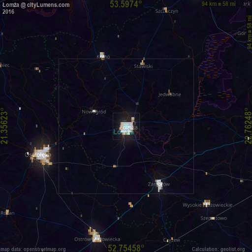
Analysis of Łomża night lights 2016
Square area 10x10 km:
 7.7%
7.7%90-99
7.32%80-89
2.15%70-79
1.01%60-69
1.64%50-59
0.88%40-49
0.51%30-39
0.51%20-29
4.04%10-19
33.96%0-9
40.28%Square area 50x50 km:
0.44%90-99
0.46%80-89
0.11%70-79
0.06%60-69
0.14%50-59
0.09%40-49
0.16%30-39
0.07%20-29
0.25%10-19
1.67%0-9
96.54%Clear (daylight) street map image can be seen on geolist.org.
Map coordinates:
53° 35' 50.6" North, 21° 21' 22.4" East
53° 10' 41" North, 22° 3' 33.7" East
52° 45' 16.5" North, 22° 45' 44.9" East
Some cities around Łomża sort by population:
• Ostrołęka
33.8 km =21 mi,  252°
252°
• Zambrów
24.7 km =15.3 mi,  150°
150°
• Ostrów Mazowiecka
43.2 km =26.8 mi,  194°
194°
• Pisz
52.6 km =32.7 mi,  341°
341°
• Kolno
27.4 km =17 mi, 341°
• Mońki
55.2 km =34.3 mi,  62°
62°
• Wysokie Mazowieckie
42.2 km =26.2 mi,  133°
133°
• Małkinia Górna
54.1 km =33.6 mi,  182°
182°
766027 (p: 63,723)
Sources (retrieved 2019-11-25):
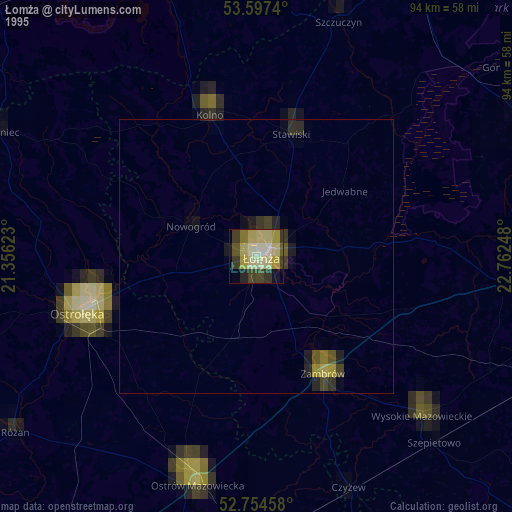
» NASA, Earths city lights 1995
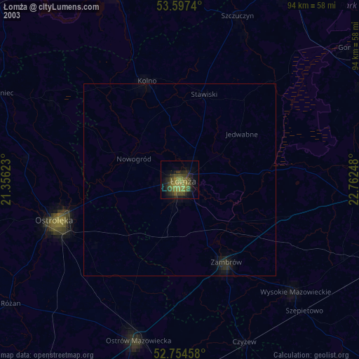
» NASA city lights 2003
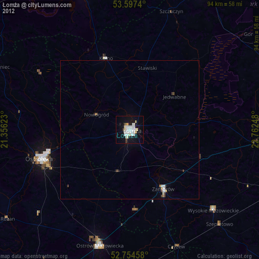
» Earth at Night: Flat Maps 2012, 2016