Mońki night lights from space
Night Light of Mońki (Podlasie) from space (Poland) Src. Average luminocity for 10x10km area is 4.6825% and for 50x50km: 0.6856%.
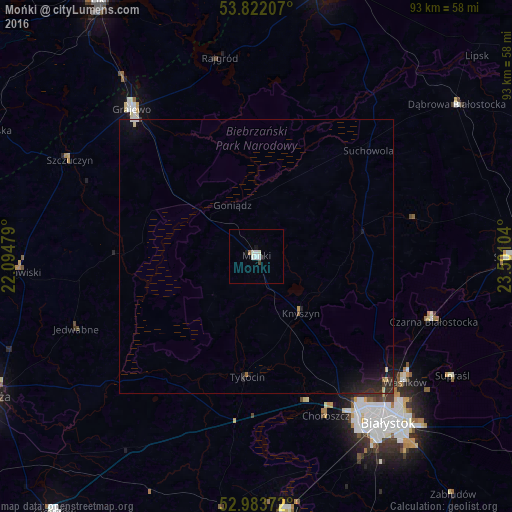
Analysis of Mońki night lights 2016
Square area 10x10 km:
 0.53%
0.53%90-99
2.65%80-89
0%70-79
0%60-69
0.53%50-59
0%40-49
0.4%30-39
0.13%20-29
0.53%10-19
1.06%0-9
94.18%Square area 50x50 km:
0.04%90-99
0.12%80-89
0.06%70-79
0.04%60-69
0.06%50-59
0.02%40-49
0.02%30-39
0.11%20-29
0.38%10-19
0.84%0-9
98.31%Clear (daylight) street map image can be seen on geolist.org.
Map coordinates:
53° 49' 19.5" North, 22° 5' 41.2" East
53° 24' 17.9" North, 22° 47' 52.5" East
52° 59' 1.4" North, 23° 30' 3.7" East
Some cities around Mońki sort by population:
• Białystok
38.8 km =24.1 mi,  141°
141°
• Grajewo
35.2 km =21.9 mi,  319°
319°
• Sokółka
46.7 km =29 mi,  89°
89°
• Łapy
46.4 km =28.8 mi,  172°
172°
• Czarna Białostocka
34 km =21.1 mi,  109°
109°
• Wasilków
35.6 km =22.1 mi,  130°
130°
• Dąbrowa Białostocka
45.7 km =28.4 mi,  52°
52°
• Choroszcz
31.7 km =19.7 mi,  156°
156°
764421 (p: 10,577)
Sources (retrieved 2019-11-25):
» Earth at Night: Flat Maps 2012, 2016