Knurów night lights from space
Night Light of Knurów (Silesia) from space (Poland) Src. Average luminocity for 10x10km area is 34.0949% and for 50x50km: 30.7056%.
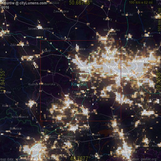
Analysis of Knurów night lights 2016
Square area 10x10 km:
 5.21%
5.21%90-99
6.28%80-89
2.81%70-79
4.28%60-69
3.88%50-59
3.88%40-49
4.14%30-39
7.89%20-29
13.64%10-19
27.01%0-9
20.99%Square area 50x50 km:
6.61%90-99
7.04%80-89
2.28%70-79
3.11%60-69
3.58%50-59
3.55%40-49
4.49%30-39
5.71%20-29
9.33%10-19
12.31%0-9
41.99%Clear (daylight) street map image can be seen on geolist.org.
Map coordinates:
50° 40' 2.9" North, 17° 56' 51.2" East
50° 13' 11" North, 18° 39' 2.4" East
49° 46' 3.7" North, 19° 21' 13.7" East
Some cities around Knurów sort by population:
• Gliwice
8.9 km =5.5 mi,  12°
12°
• Zabrze
15.1 km =9.4 mi,  39°
39°
• Ruda Śląska
15.2 km =9.4 mi,  73°
73°
• Rybnik
15.7 km =9.8 mi,  209°
209°
• Czerwionka-Leszczyny
8 km =5 mi,  166°
166°
• Łaziska Górne
15.7 km =9.8 mi,  119°
119°
• Orzesze
11.6 km =7.2 mi,  127°
127°
• Ornontowice
7.9 km =4.9 mi,  111°
111°
3095971 (p: 39,744)
Sources (retrieved 2019-11-25):
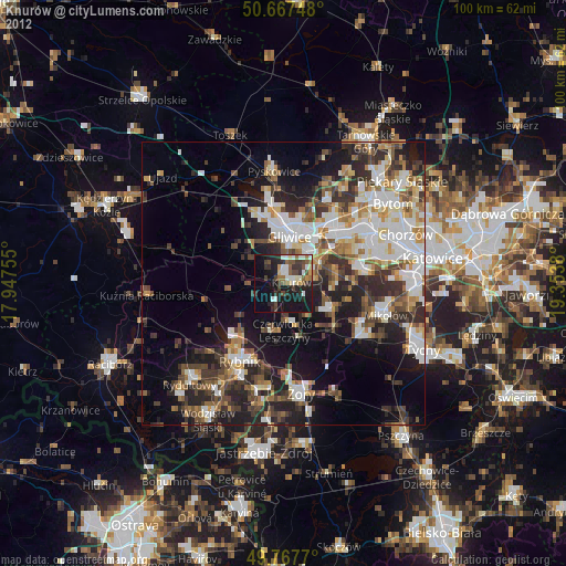
» Earth at Night: Flat Maps 2012, 2016