Gliwice night lights from space
Night Light of Gliwice (Silesia) from space (Poland) Src. Average luminocity for 10x10km area is 76.9626% and for 50x50km: 29.2711%.
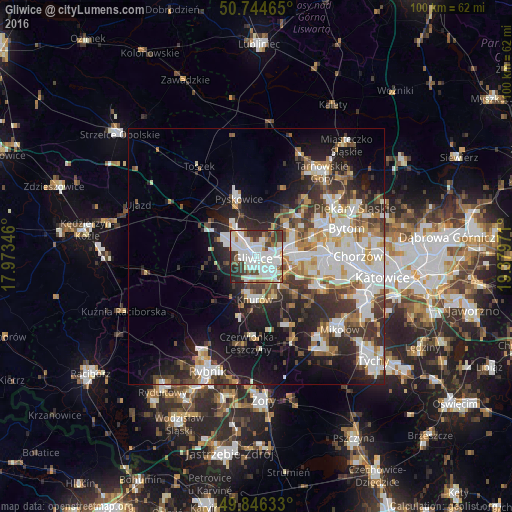

Analysis of Gliwice night lights 2016
Square area 10x10 km:
 27.54%
90-99
29.14%80-89
4.95%70-79
2.27%60-69
4.81%50-59
5.88%40-49
7.22%30-39
12.57%20-29
4.95%10-19
0.67%0-9
0%Square area 50x50 km:
6.79%90-99
7.19%80-89
2.14%70-79
3.03%60-69
3.19%50-59
3.03%40-49
3.9%30-39
5.15%20-29
7.26%10-19
11.8%0-9
46.5%Clear (daylight) street map image can be seen on geolist.org.
Map coordinates:
50° 44' 40.7" North, 17° 58' 24.5" East
50° 17' 51.4" North, 18° 40' 35.7" East
49° 50' 46.8" North, 19° 22' 47" East
Some cities around Gliwice sort by population:
• Zabrze
8.3 km =5.2 mi,  68°
68°
• Ruda Śląska
13.5 km =8.4 mi,  108°
108°
• Świętochłowice
17.1 km =10.6 mi,  90°
90°
• Knurów
8.9 km =5.5 mi,  192°
192°
• Czerwionka-Leszczyny
16.4 km =10.2 mi,  179°
179°
• Pyskowice
11.8 km =7.3 mi,  344°
344°
• Orzesze
17.4 km =10.8 mi,  155°
155°
• Ornontowice
12.8 km =8 mi,  154°
154°
3099230 (p: 198,835)
Sources (retrieved 2019-11-25):
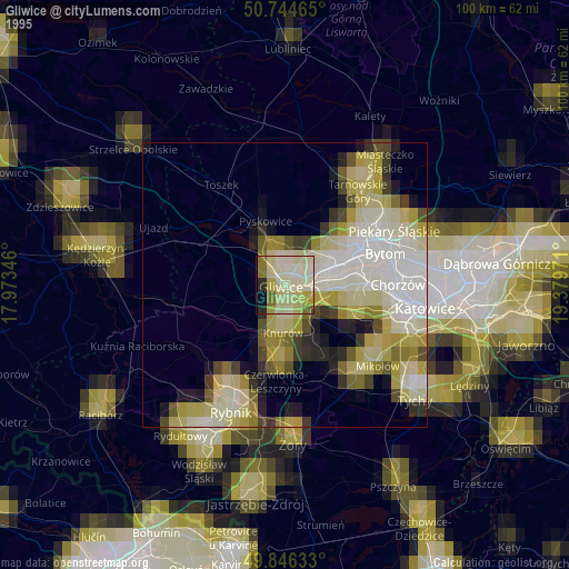
» NASA, Earths city lights 1995
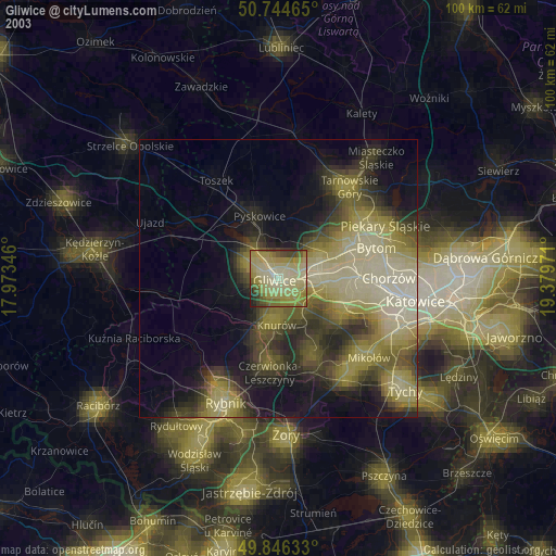
» NASA city lights 2003
» Earth at Night: Flat Maps 2012, 2016