Zabrze night lights from space
Night Light of Zabrze (Silesia) from space (Poland) Src. Average luminocity for 10x10km area is 75.1373% and for 50x50km: 34.3553%.
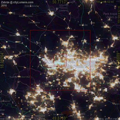
Analysis of Zabrze night lights 2016
Square area 10x10 km:
 19.61%
90-99
21.29%80-89
7%70-79
13.73%60-69
11.06%50-59
7.84%40-49
9.8%30-39
6.58%20-29
2.52%10-19
0.56%0-9
0%Square area 50x50 km:
8.3%90-99
8.54%80-89
2.54%70-79
3.57%60-69
3.89%50-59
3.76%40-49
4.54%30-39
5.45%20-29
8.75%10-19
11.52%0-9
39.14%Clear (daylight) street map image can be seen on geolist.org.
Map coordinates:
50° 46' 18.1" North, 18° 4' 57.5" East
50° 19' 29.7" North, 18° 47' 8.7" East
49° 52' 26" North, 19° 29' 20" East
Some cities around Zabrze sort by population:
• Gliwice
8.3 km =5.2 mi,  248°
248°
• Bytom
10.7 km =6.6 mi,  76°
76°
• Ruda Śląska
8.9 km =5.5 mi,  145°
145°
• Chorzów
13.5 km =8.4 mi,  99°
99°
• Piekary Śląskie
11.7 km =7.3 mi,  58°
58°
• Świętochłowice
9.9 km =6.2 mi,  108°
108°
• Pyskowice
13.7 km =8.5 mi,  307°
307°
• Radzionków
11.8 km =7.3 mi,  44°
44°
3080985 (p: 192,177)
Sources (retrieved 2019-11-25):
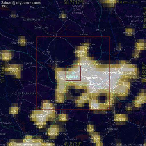
» NASA, Earths city lights 1995
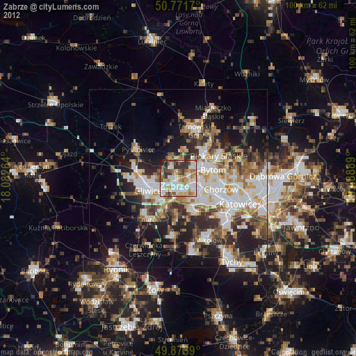
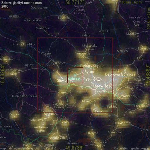
» NASA city lights 2003
» Earth at Night: Flat Maps 2012, 2016