Czersk night lights from space
Night Light of Czersk (Pomerania) from space (Poland) Src. Average luminocity for 10x10km area is 3.9431% and for 50x50km: 1.055%.
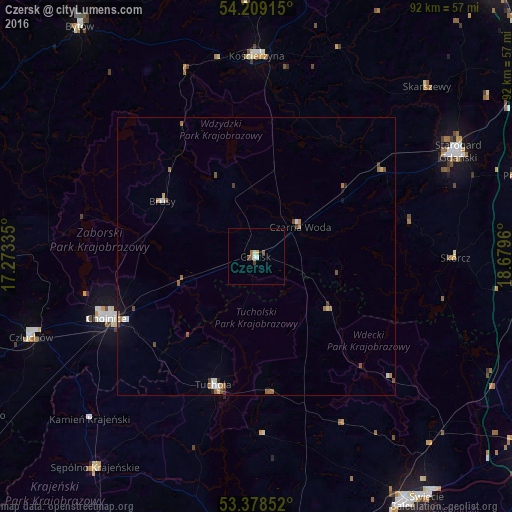
Analysis of Czersk night lights 2016
Square area 10x10 km:
 0%
0%90-99
1.59%80-89
0.13%70-79
0.4%60-69
0.53%50-59
1.06%40-49
1.06%30-39
0%20-29
0%10-19
0%0-9
95.24%Square area 50x50 km:
0.07%90-99
0.22%80-89
0.08%70-79
0.09%60-69
0.27%50-59
0.26%40-49
0.22%30-39
0.07%20-29
0.06%10-19
0.18%0-9
98.49%Clear (daylight) street map image can be seen on geolist.org.
Map coordinates:
54° 12' 32.9" North, 17° 16' 24.1" East
53° 47' 45.2" North, 17° 58' 35.3" East
53° 22' 42.7" North, 18° 40' 46.6" East
Some cities around Czersk sort by population:
• Starogard Gdański
40.6 km =25.2 mi,  62°
62°
• Chojnice
29.8 km =18.5 mi,  247°
247°
• Kościerzyna
36.3 km =22.6 mi,  0°
0°
• Człuchów
43.1 km =26.8 mi, 250°
• Tuchola
24.4 km =15.2 mi,  198°
198°
• Sępólno Krajeńskie
48.2 km =30 mi,  217°
217°
• Pelplin
49.5 km =30.8 mi,  72°
72°
• Skarszewy
43.1 km =26.8 mi,  45°
45°
3100984 (p: 9,390)
Sources (retrieved 2019-11-25):
» Earth at Night: Flat Maps 2012, 2016