Skarszewy night lights from space
Night Light of Skarszewy (Pomerania) from space (Poland) Src. Average luminocity for 10x10km area is 2.0391% and for 50x50km: 5.0613%.
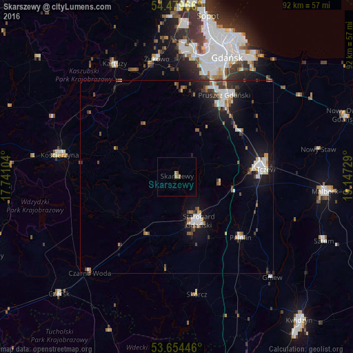
Analysis of Skarszewy night lights 2016
Square area 10x10 km:
 0%
0%90-99
0%80-89
0.51%70-79
0.51%60-69
0.51%50-59
1.01%40-49
0%30-39
0%20-29
0%10-19
0%0-9
97.47%Square area 50x50 km:
0.94%90-99
0.91%80-89
0.18%70-79
0.46%60-69
0.69%50-59
0.52%40-49
0.74%30-39
0.74%20-29
1.02%10-19
4.2%0-9
89.61%Clear (daylight) street map image can be seen on geolist.org.
Map coordinates:
54° 28' 46.8" North, 17° 44' 27.7" East
54° 4' 8.8" North, 18° 26' 39" East
53° 39' 16.1" North, 19° 8' 50.2" East
Some cities around Skarszewy sort by population:
• Gdańsk
34.1 km =21.2 mi,  22°
22°
• Tczew
21.9 km =13.6 mi,  83°
83°
• Starogard Gdański
12.9 km =8 mi,  155°
155°
• Pruszcz Gdański
24.8 km =15.4 mi,  30°
30°
• Kościerzyna
30.8 km =19.1 mi,  281°
281°
• Kartuzy
33.6 km =20.9 mi,  331°
331°
• Pelplin
22.8 km =14.2 mi,  133°
133°
• Żukowo
30.8 km =19.1 mi,  350°
350°
3085826 (p: 6,942)
Sources (retrieved 2019-11-25):
» Earth at Night: Flat Maps 2012, 2016