Sępólno Krajeńskie night lights from space
Night Light of Sępólno Krajeńskie (Kujawsko-Pomorskie) from space (Poland) Src. Average luminocity for 10x10km area is 4.6534% and for 50x50km: 1.0298%.
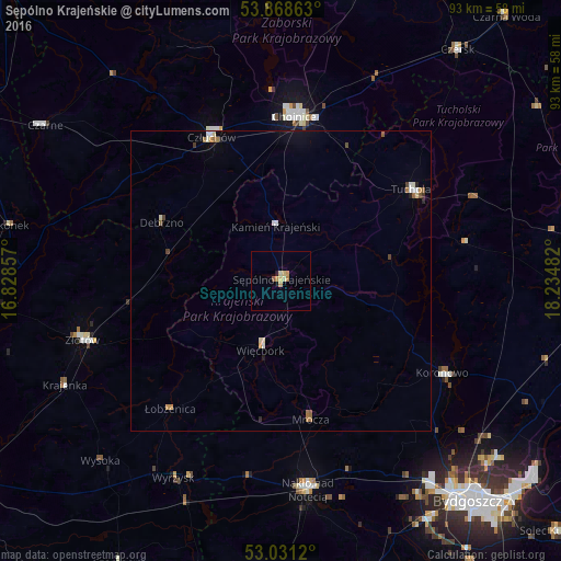
Analysis of Sępólno Krajeńskie night lights 2016
Square area 10x10 km:
 0%
0%90-99
0.4%80-89
1.72%70-79
1.59%60-69
0.53%50-59
0.53%40-49
0%30-39
0%20-29
0.53%10-19
0.53%0-9
94.18%Square area 50x50 km:
0.08%90-99
0.17%80-89
0.18%70-79
0.13%60-69
0.17%50-59
0.15%40-49
0.08%30-39
0.07%20-29
0.12%10-19
0.2%0-9
98.65%Clear (daylight) street map image can be seen on geolist.org.
Map coordinates:
53° 52' 7.1" North, 16° 49' 42.9" East
53° 27' 7.1" North, 17° 31' 54.1" East
53° 1' 52.3" North, 18° 14' 5.4" East
Some cities around Sępólno Krajeńskie sort by population:
• Chojnice
27.1 km =16.8 mi,  3°
3°
• Nakło nad Notecią
34.8 km =21.6 mi,  172°
172°
• Złotów
34 km =21.1 mi,  253°
253°
• Człuchów
26.5 km =16.5 mi,  334°
334°
• Tuchola
26.4 km =16.4 mi,  55°
55°
• Koronowo
31 km =19.3 mi,  119°
119°
• Więcbork
11.2 km =7 mi,  194°
194°
• Debrzno
21.8 km =13.5 mi,  296°
296°
3086153 (p: 9,223)
Sources (retrieved 2019-11-25):
» Earth at Night: Flat Maps 2012, 2016