Khalabat night lights from space
Night Light of Khalabat (Khyber Pakhtunkhwa) from space (Pakistan) Src. Average luminocity for 10x10km area is 9.7955% and for 50x50km: 6.2982%.
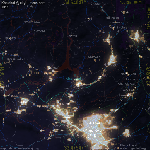
Analysis of Khalabat night lights 2016
Square area 10x10 km:
 0%
0%90-99
1.4%80-89
0.7%70-79
1.22%60-69
0.87%50-59
1.57%40-49
4.02%30-39
2.1%20-29
1.22%10-19
9.27%0-9
77.62%Square area 50x50 km:
0.09%90-99
1.17%80-89
0.42%70-79
0.53%60-69
0.64%50-59
1.05%40-49
1.7%30-39
1.2%20-29
1.28%10-19
6.78%0-9
85.15%Clear (daylight) street map image can be seen on geolist.org.
Map coordinates:
34° 38' 25.7" North, 72° 11' 11.4" East
34° 3' 35.9" North, 72° 53' 22.7" East
33° 28' 31.7" North, 73° 35' 33.9" East
Some cities around Khalabat sort by population:
• Islamabad
40.2 km =25 mi,  159°
159°
• Abbottabad
31.2 km =19.4 mi,  72°
72°
• Swabi
39.2 km =24.4 mi,  279°
279°
• Haripur
8.1 km =5 mi,  148°
148°
• Havelian
24.9 km =15.5 mi,  91°
91°
• Topi
24.7 km =15.3 mi,  272°
272°
• Zaida
38.9 km =24.2 mi, 269°
• Hazro City
40.3 km =25 mi,  245°
245°
1174301 (p: 39,148)
Sources (retrieved 2019-11-25):
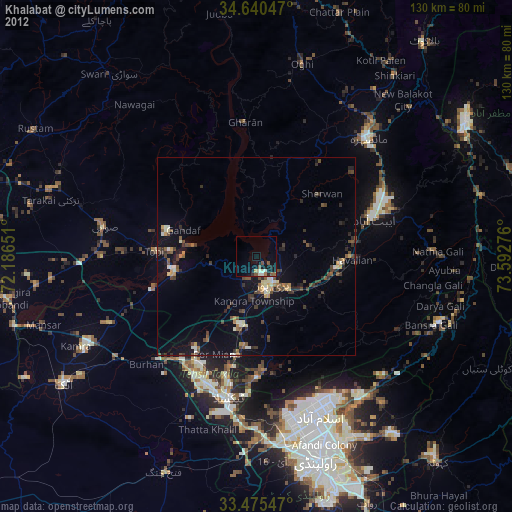
» Earth at Night: Flat Maps 2012, 2016