Sialkot night lights from space
Night Light of Sialkot (Punjab) from space (Pakistan) Src. Average luminocity for 10x10km area is 74.9982% and for 50x50km: 15.7914%.
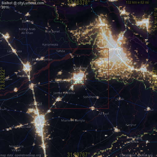
Analysis of Sialkot night lights 2016
Square area 10x10 km:
 12.27%
90-99
35.9%80-89
8.61%70-79
5.31%60-69
7.33%50-59
8.61%40-49
8.06%30-39
7.33%20-29
5.49%10-19
1.1%0-9
0%Square area 50x50 km:
1.13%90-99
3.5%80-89
1.87%70-79
2.02%60-69
2.16%50-59
2.5%40-49
3.21%30-39
3.02%20-29
3.99%10-19
7.28%0-9
69.32%Clear (daylight) street map image can be seen on geolist.org.
Map coordinates:
33° 5' 1.6" North, 73° 49' 41.6" East
32° 29' 33.6" North, 74° 31' 52.8" East
31° 53' 51.6" North, 75° 14' 4.1" East
Some cities around Sialkot sort by population:
• Daska Kalan
25.3 km =15.7 mi,  222°
222°
• Sambrial
16.8 km =10.4 mi,  264°
264°
• Hadali
16.8 km =10.4 mi,  12°
12°
• Chawinda
23.2 km =14.4 mi,  135°
135°
• Kotli Loharan
11.2 km =7 mi,  342°
342°
• Kot Ghulam Muhammad
17.8 km =11.1 mi,  175°
175°
• Bhopalwala
17.2 km =10.7 mi,  246°
246°
• Norīa, IN
25.2 km =15.7 mi,  82°
82°
1164909 (p: 477,396)
Sources (retrieved 2019-11-25):
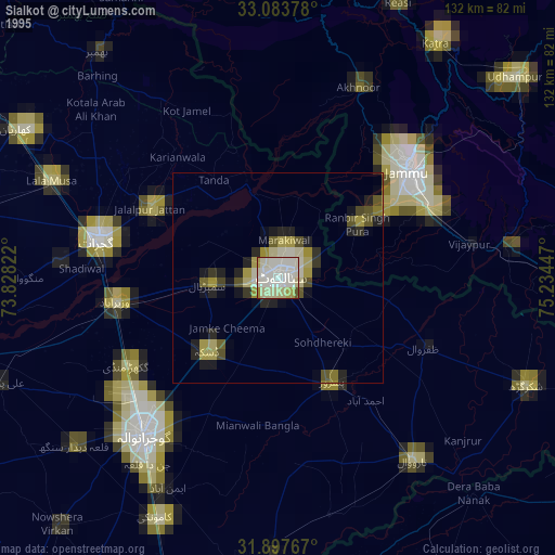
» NASA, Earths city lights 1995
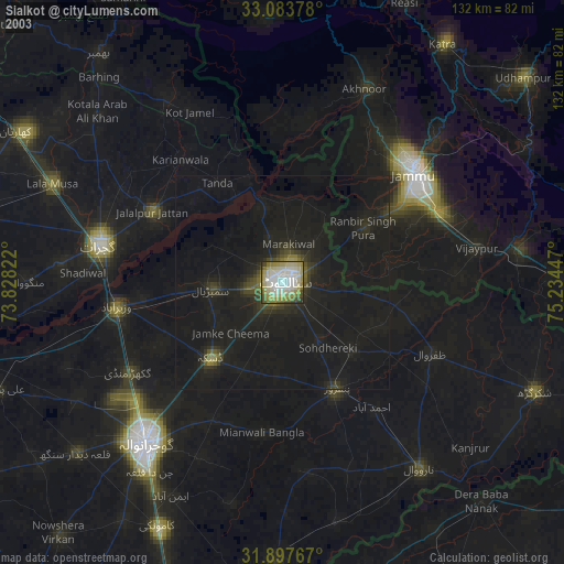
» NASA city lights 2003
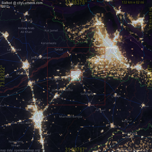
» Earth at Night: Flat Maps 2012, 2016