Kotli Loharan night lights from space
Night Light of Kotli Loharan (Punjab) from space (Pakistan) Src. Average luminocity for 10x10km area is 9.0839% and for 50x50km: 15.4914%.
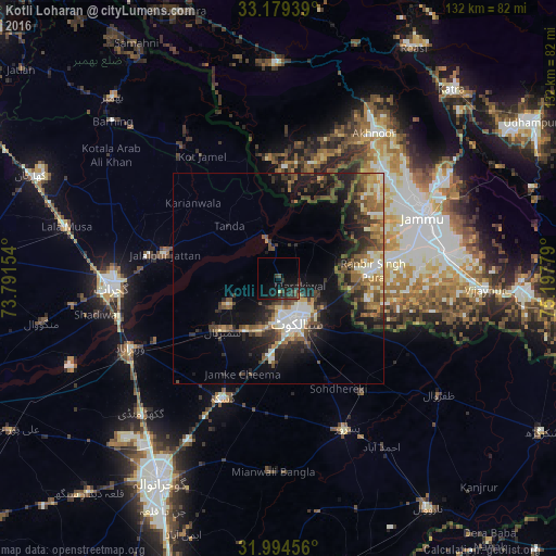
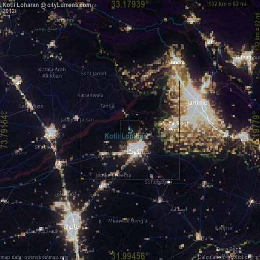
Analysis of Kotli Loharan night lights 2016
Square area 10x10 km:
 0%
0%90-99
0%80-89
0.7%70-79
0.17%60-69
0.35%50-59
0%40-49
4.02%30-39
4.02%20-29
5.94%10-19
14.16%0-9
70.63%Square area 50x50 km:
1.01%90-99
2.98%80-89
1.67%70-79
1.5%60-69
2.18%50-59
2.65%40-49
3.95%30-39
3.41%20-29
4.59%10-19
9.15%0-9
66.89%Clear (daylight) street map image can be seen on geolist.org.
Map coordinates:
33° 10' 45.8" North, 73° 47' 29.5" East
32° 35' 20.1" North, 74° 29' 40.8" East
31° 59' 40.4" North, 75° 11' 52" East
Some cities around Kotli Loharan sort by population:
• Sialkot
11.2 km =7 mi,  162°
162°
• Jalalpur Jattan
27.7 km =17.2 mi,  282°
282°
• Sambrial
18.1 km =11.2 mi,  227°
227°
• Hadali
9 km =5.6 mi,  50°
50°
• Surkhpur
15 km =9.3 mi,  342°
342°
• Bhopalwala
21.6 km =13.4 mi,  214°
214°
• Nawānshahr, IN
19.8 km =12.3 mi,  8°
8°
• Begowala
27.1 km =16.8 mi, 231°
1173025 (p: 21,463)
Sources (retrieved 2019-11-25):
» Earth at Night: Flat Maps 2012, 2016