Pasrur night lights from space
Night Light of Pasrur (Punjab) from space (Pakistan) Src. Average luminocity for 10x10km area is 9% and for 50x50km: 4.3049%.
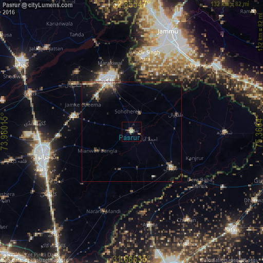
Analysis of Pasrur night lights 2016
Square area 10x10 km:
 0%
0%90-99
0.55%80-89
1.65%70-79
2.01%60-69
2.38%50-59
1.1%40-49
2.38%30-39
1.1%20-29
1.28%10-19
0.37%0-9
87.18%Square area 50x50 km:
0.11%90-99
0.69%80-89
0.42%70-79
0.28%60-69
0.51%50-59
0.76%40-49
0.99%30-39
1.19%20-29
1.53%10-19
2.83%0-9
90.69%Clear (daylight) street map image can be seen on geolist.org.
Map coordinates:
32° 51' 19.7" North, 73° 57' 36.5" East
32° 15' 46.3" North, 74° 39' 47.8" East
31° 39' 58.9" North, 75° 21' 59" East
Some cities around Pasrur sort by population:
• Sialkot
28.4 km =17.6 mi,  334°
334°
• Daska Kalan
30.2 km =18.8 mi,  283°
283°
• Narowal
26.6 km =16.5 mi,  132°
132°
• Chawinda
9.9 km =6.2 mi,  23°
23°
• Zafarwal
24 km =14.9 mi,  67°
67°
• Kot Ghulam Muhammad
13.4 km =8.3 mi,  305°
305°
• Baddomalhi
30.3 km =18.8 mi,  179°
179°
• Kalaswala
7 km =4.3 mi,  191°
191°
1168307 (p: 53,364)
Sources (retrieved 2019-11-25):
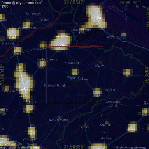
» NASA, Earths city lights 1995
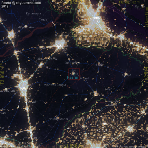
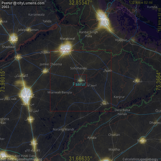
» NASA city lights 2003
» Earth at Night: Flat Maps 2012, 2016