Narowal night lights from space
Night Light of Narowal (Punjab) from space (Pakistan) Src. Average luminocity for 10x10km area is 12.542% and for 50x50km: 3.73%.
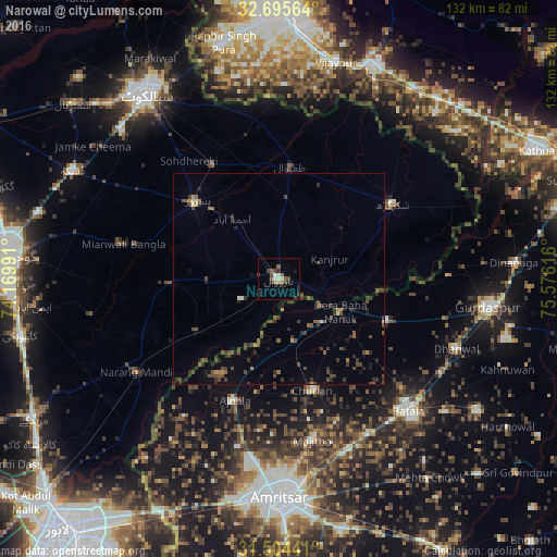
Analysis of Narowal night lights 2016
Square area 10x10 km:
 0%
0%90-99
2.1%80-89
1.4%70-79
0.7%60-69
1.22%50-59
3.67%40-49
3.67%30-39
1.57%20-29
2.45%10-19
2.27%0-9
80.94%Square area 50x50 km:
0.01%90-99
0.22%80-89
0.12%70-79
0.32%60-69
0.36%50-59
0.75%40-49
1.58%30-39
1.31%20-29
1.27%10-19
0.99%0-9
93.07%Clear (daylight) street map image can be seen on geolist.org.
Map coordinates:
32° 41' 44.3" North, 74° 10' 11.7" East
32° 6' 7.1" North, 74° 52' 22.9" East
31° 30' 15.9" North, 75° 34' 34.2" East
Some cities around Narowal sort by population:
• Pasrur
26.6 km =16.5 mi,  312°
312°
• Fazilpur
19.9 km =12.4 mi,  65°
65°
• Zafarwal
27.1 km =16.8 mi,  5°
5°
• Baddomalhi
23.3 km =14.5 mi,  237°
237°
• Fatehgarh Chūriān, IN
27.6 km =17.1 mi,  163°
163°
• Kalaswala
23.8 km =14.8 mi,  297°
297°
• Derā Nānak, IN
16.3 km =10.1 mi,  116°
116°
• Rām Dās, IN
15.3 km =9.5 mi,  167°
167°
1169278 (p: 68,291)
Sources (retrieved 2019-11-25):
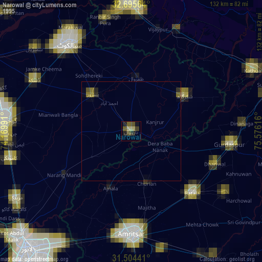
» NASA, Earths city lights 1995
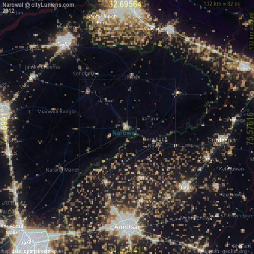
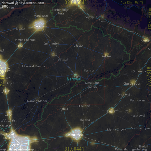
» NASA city lights 2003
» Earth at Night: Flat Maps 2012, 2016