Pasni night lights from space
Night Light of Pasni (Balochistan) from space (Pakistan) Src. Average luminocity for 10x10km area is 6.375% and for 50x50km: 0.2731%.
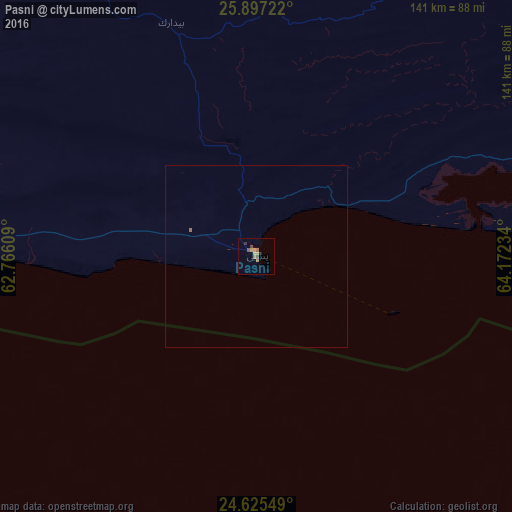
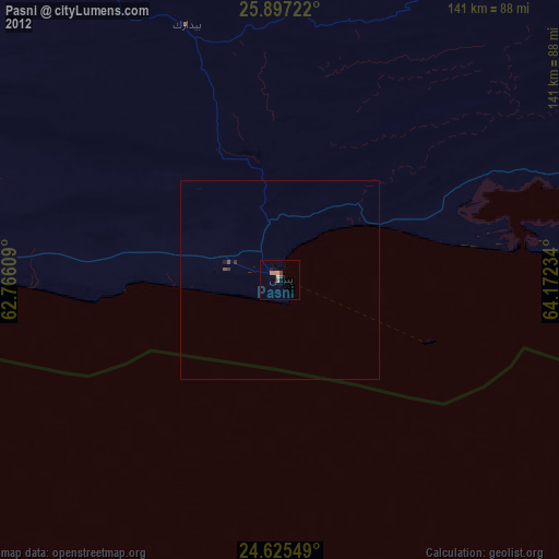
Analysis of Pasni night lights 2016
Square area 10x10 km:
 0%
0%90-99
0%80-89
1.59%70-79
1.59%60-69
1.59%50-59
1.39%40-49
1.19%30-39
1.39%20-29
0.4%10-19
0.4%0-9
90.48%Square area 50x50 km:
0%90-99
0%80-89
0.06%70-79
0.06%60-69
0.07%50-59
0.08%40-49
0.05%30-39
0.05%20-29
0.02%10-19
0.02%0-9
99.6%Clear (daylight) street map image can be seen on geolist.org.
Map coordinates:
25° 53' 50" North, 62° 45' 57.9" East
25° 15' 46.9" North, 63° 28' 9.2" East
24° 37' 31.8" North, 64° 10' 20.4" East
Some cities around Pasni sort by population:
• Turbat
92.3 km =57.4 mi,  332°
332°
• Gwadar
116.2 km =72.2 mi,  262°
262°
• Chabahar, IR
284.2 km =176.6 mi,  270°
270°
• Qaşr-e Qand, IR
293.3 km =182.2 mi,  291°
291°
• Bela
304.2 km =189 mi,  69°
69°
• Uthal
322 km =200.1 mi,  79°
79°
• Jiwani
175.1 km =108.8 mi, 262°
• Ormara
117.5 km =73 mi,  92°
92°
1168312 (p: 33,110)
Sources (retrieved 2019-11-25):
» Earth at Night: Flat Maps 2012, 2016