Mingora night lights from space
Night Light of Mingora (Khyber Pakhtunkhwa) from space (Pakistan) Src. Average luminocity for 10x10km area is 23.6099% and for 50x50km: 1.2503%.
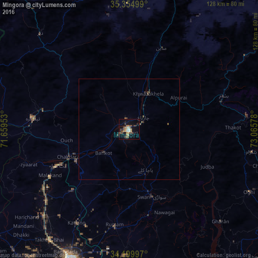
Analysis of Mingora night lights 2016
Square area 10x10 km:
 0.18%
0.18%90-99
4.21%80-89
2.93%70-79
4.21%60-69
2.93%50-59
2.75%40-49
7.69%30-39
3.66%20-29
2.38%10-19
18.86%0-9
50.18%Square area 50x50 km:
0.01%90-99
0.16%80-89
0.11%70-79
0.16%60-69
0.14%50-59
0.23%40-49
0.45%30-39
0.18%20-29
0.24%10-19
0.87%0-9
97.44%Clear (daylight) street map image can be seen on geolist.org.
Map coordinates:
35° 21' 18" North, 71° 39' 34.3" East
34° 46' 46.2" North, 72° 21' 45.5" East
34° 11' 59.9" North, 73° 3' 56.8" East
Some cities around Mingora sort by population:
• Battagram
61.4 km =38.2 mi,  100°
100°
• Mardan
70.7 km =43.9 mi,  203°
203°
• Swabi
74 km =46 mi,  172°
172°
• Bat Khela
39.9 km =24.8 mi,  243°
243°
• Topi
82.3 km =51.1 mi,  163°
163°
• Upper Dir
65 km =40.4 mi,  317°
317°
• Thal
78.5 km =48.8 mi,  352°
352°
• Zaida
80.6 km =50.1 mi, 173°
1170395 (p: 279,914)
Sources (retrieved 2019-11-25):
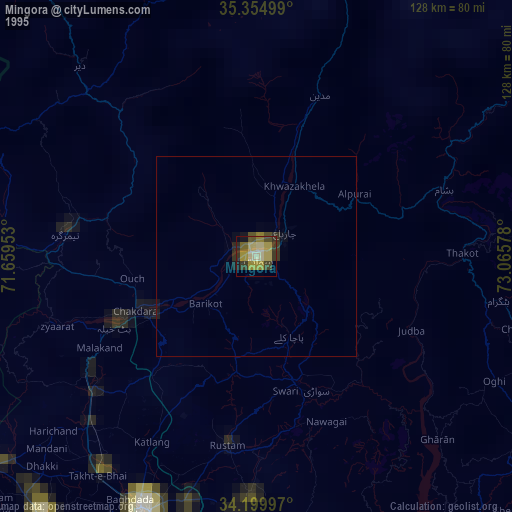
» NASA, Earths city lights 1995
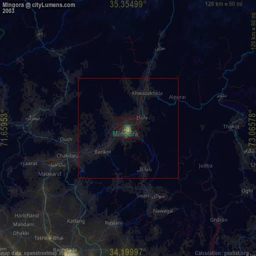
» NASA city lights 2003
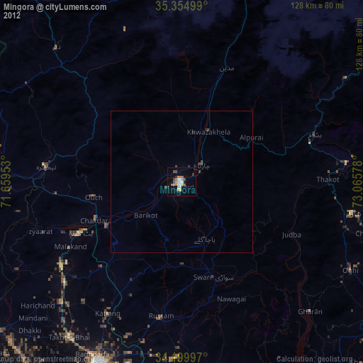
» Earth at Night: Flat Maps 2012, 2016