Lachi night lights from space
Night Light of Lachi (Khyber Pakhtunkhwa) from space (Pakistan) Src. Average luminocity for 10x10km area is 0.4983% and for 50x50km: 4.2222%.
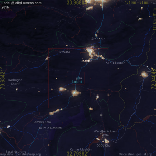
Analysis of Lachi night lights 2016
Square area 10x10 km:
 0%
0%90-99
0%80-89
0%70-79
0%60-69
0%50-59
0%40-49
0%30-39
0.17%20-29
1.22%10-19
0%0-9
98.6%Square area 50x50 km:
0.17%90-99
0.63%80-89
0.62%70-79
0.28%60-69
0.37%50-59
0.83%40-49
1.02%30-39
0.89%20-29
1.08%10-19
2.56%0-9
91.55%Clear (daylight) street map image can be seen on geolist.org.
Map coordinates:
33° 58' 4.9" North, 70° 38' 3.2" East
33° 22' 58.5" North, 71° 20' 14.4" East
32° 47' 37.8" North, 72° 2' 25.7" East
Some cities around Lachi sort by population:
• Kohat
24.4 km =15.2 mi,  25°
25°
• Hangu
30.6 km =19 mi,  302°
302°
• Daud Khel
60.5 km =37.6 mi,  158°
158°
• Jand
63.5 km =39.5 mi,  84°
84°
• Kalabagh
50.7 km =31.5 mi, 157°
• Kamar Mushani
60.1 km =37.3 mi,  177°
177°
• Karak
37.3 km =23.2 mi,  217°
217°
• Doaba
55.9 km =34.7 mi,  274°
274°
1172513 (p: 18,537)
Sources (retrieved 2019-11-25):
» Earth at Night: Flat Maps 2012, 2016