Kohat night lights from space
Night Light of Kohat (Khyber Pakhtunkhwa) from space (Pakistan) Src. Average luminocity for 10x10km area is 39.4982% and for 50x50km: 2.8311%.
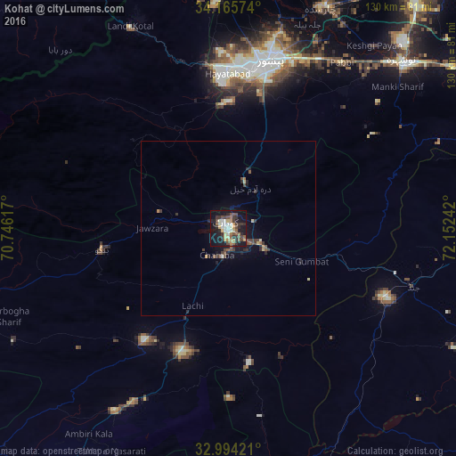
Analysis of Kohat night lights 2016
Square area 10x10 km:
 2.75%
2.75%90-99
8.24%80-89
6.59%70-79
4.21%60-69
4.76%50-59
5.49%40-49
7.88%30-39
8.61%20-29
10.26%10-19
33.52%0-9
7.69%Square area 50x50 km:
0.11%90-99
0.38%80-89
0.4%70-79
0.22%60-69
0.31%50-59
0.37%40-49
0.76%30-39
0.67%20-29
0.86%10-19
2.45%0-9
93.47%Clear (daylight) street map image can be seen on geolist.org.
Map coordinates:
34° 9' 56.7" North, 70° 44' 46.2" East
33° 34' 55.1" North, 71° 26' 57.4" East
32° 59' 39.2" North, 72° 9' 8.7" East
Some cities around Kohat sort by population:
• Peshawar
48.9 km =30.4 mi,  14°
14°
• Pabbi
57.3 km =35.6 mi,  33°
33°
• Hangu
36.5 km =22.7 mi,  261°
261°
• Aman Garh
64.7 km =40.2 mi,  43°
43°
• Lachi
24.4 km =15.2 mi,  205°
205°
• Jand
55.3 km =34.4 mi,  107°
107°
• Karak
61.4 km =38.2 mi, 212°
• Doaba
68.3 km =42.4 mi, 255°
1173491 (p: 151,427)
Sources (retrieved 2019-11-25):
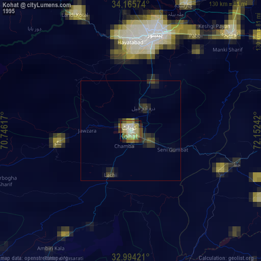
» NASA, Earths city lights 1995
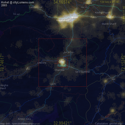
» NASA city lights 2003
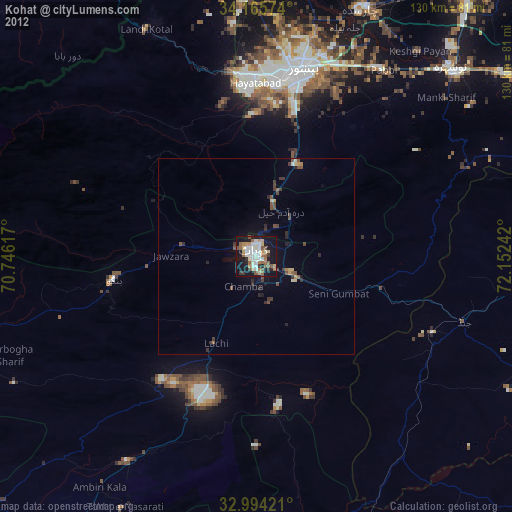
» Earth at Night: Flat Maps 2012, 2016