Karak night lights from space
Night Light of Karak (Khyber Pakhtunkhwa) from space (Pakistan) Src. Average luminocity for 10x10km area is 8.8755% and for 50x50km: 2.1035%.
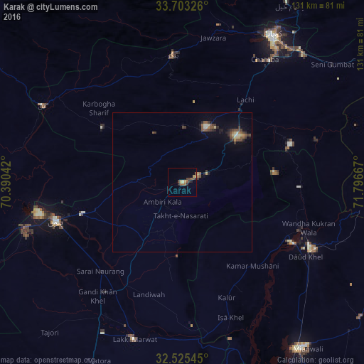
Analysis of Karak night lights 2016
Square area 10x10 km:
 0%
0%90-99
0.55%80-89
0.92%70-79
1.83%60-69
2.38%50-59
1.65%40-49
1.65%30-39
2.2%20-29
2.2%10-19
0.37%0-9
86.26%Square area 50x50 km:
0.05%90-99
0.17%80-89
0.31%70-79
0.2%60-69
0.21%50-59
0.61%40-49
0.47%30-39
0.47%20-29
0.42%10-19
0.74%0-9
96.35%Clear (daylight) street map image can be seen on geolist.org.
Map coordinates:
33° 42' 11.7" North, 70° 23' 25.5" East
33° 6' 58.8" North, 71° 5' 36.7" East
32° 31' 31.6" North, 71° 47' 48" East
Some cities around Karak sort by population:
• Bannu
47.9 km =29.8 mi,  252°
252°
• Hangu
46.3 km =28.8 mi,  356°
356°
• Daud Khel
52 km =32.3 mi,  121°
121°
• Sarai Naurang
43.5 km =27 mi,  222°
222°
• Lachi
37.3 km =23.2 mi,  37°
37°
• Kalabagh
45.6 km =28.3 mi,  112°
112°
• Kamar Mushani
39.4 km =24.5 mi,  140°
140°
• Doaba
47.7 km =29.6 mi,  315°
315°
1174074 (p: 13,679)
Sources (retrieved 2019-11-25):
» Earth at Night: Flat Maps 2012, 2016