Pabbi night lights from space
Night Light of Pabbi (Khyber Pakhtunkhwa) from space (Pakistan) Src. Average luminocity for 10x10km area is 17.9231% and for 50x50km: 17.1491%.
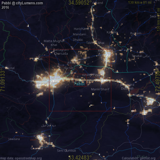
Analysis of Pabbi night lights 2016
Square area 10x10 km:
 0%
0%90-99
0%80-89
1.22%70-79
0.52%60-69
2.62%50-59
7.34%40-49
6.47%30-39
3.5%20-29
5.24%10-19
20.1%0-9
52.97%Square area 50x50 km:
1.33%90-99
3.92%80-89
1.75%70-79
1.31%60-69
1.72%50-59
3.13%40-49
4.1%30-39
3.68%20-29
5.06%10-19
10.3%0-9
63.68%Clear (daylight) street map image can be seen on geolist.org.
Map coordinates:
34° 35' 25.9" North, 71° 5' 28.8" East
34° 0' 34.8" North, 71° 47' 40" East
33° 25' 29.4" North, 72° 29' 51.3" East
Some cities around Pabbi sort by population:
• Peshawar
19.9 km =12.4 mi,  269°
269°
• Mardan
31.5 km =19.6 mi,  48°
48°
• Nowshera Cantonment
18.8 km =11.7 mi,  93°
93°
• Charsadda
16.2 km =10.1 mi,  342°
342°
• Risalpur Cantonment
19.1 km =11.9 mi,  72°
72°
• Utmanzai
20 km =12.4 mi,  351°
351°
• Aman Garh
12.5 km =7.8 mi, 91°
• Akora
30.5 km =19 mi, 91°
1168680 (p: 37,307)
Sources (retrieved 2019-11-25):
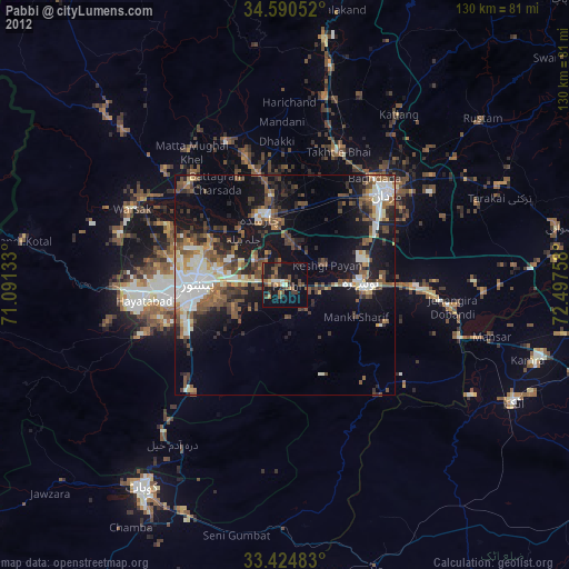
» Earth at Night: Flat Maps 2012, 2016