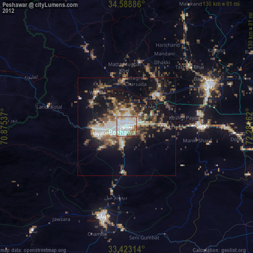
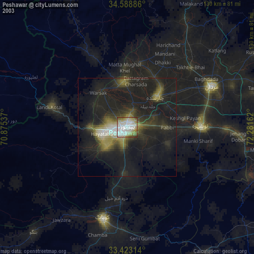
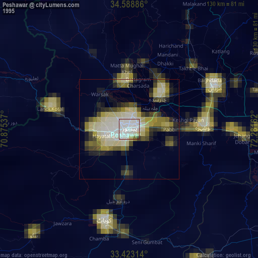
Peshawar night lights from space
Night Light of Peshawar (Khyber Pakhtunkhwa) from space (Pakistan) Src. Average luminocity for 10x10km area is 85.0962% and for 50x50km: 16.0413%.
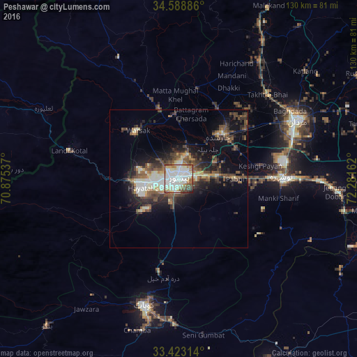
Analysis of Peshawar night lights 2016
Square area 10x10 km:
 21.33%
90-99
42.66%80-89
8.39%70-79
5.94%60-69
5.77%50-59
7.34%40-49
6.12%30-39
1.92%20-29
0.35%10-19
0.17%0-9
0%Square area 50x50 km:
1.55%90-99
3.92%80-89
1.66%70-79
1.08%60-69
1.6%50-59
3.02%40-49
3.7%30-39
2.87%20-29
4.27%10-19
8.5%0-9
67.83%Clear (daylight) street map image can be seen on geolist.org.
Map coordinates:
34° 35' 19.9" North, 70° 52' 31.3" East
34° 0' 28.8" North, 71° 34' 42.6" East
33° 25' 23.3" North, 72° 16' 53.8" East
Some cities around Peshawar sort by population:
• Nowshera Cantonment
38.7 km =24 mi,  91°
91°
• Charsadda
21.6 km =13.4 mi,  43°
43°
• Shabqadar
23.2 km =14.4 mi,  354°
354°
• Pabbi
19.9 km =12.4 mi, 89°
• Risalpur Cantonment
38.6 km =24 mi,  81°
81°
• Tangi
33.3 km =20.7 mi,  11°
11°
• Utmanzai
26.2 km =16.3 mi, 40°
• Aman Garh
32.4 km =20.1 mi, 90°
1168197 (p: 1,218,773)
Sources (retrieved 2019-11-25):
» NASA, Earths city lights 1995
» NASA city lights 2003
» Earth at Night: Flat Maps 2012, 2016