Khurrianwala night lights from space
Night Light of Khurrianwala (Punjab) from space (Pakistan) Src. Average luminocity for 10x10km area is 46.8304% and for 50x50km: 20.0409%.
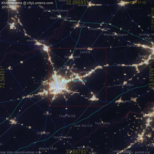

Analysis of Khurrianwala night lights 2016
Square area 10x10 km:
 2.97%
2.97%90-99
12.06%80-89
4.55%70-79
6.64%60-69
8.04%50-59
5.94%40-49
9.97%30-39
7.52%20-29
19.06%10-19
23.08%0-9
0.17%Square area 50x50 km:
2.23%90-99
6.27%80-89
1.68%70-79
1.6%60-69
1.91%50-59
2.7%40-49
3.26%30-39
3.15%20-29
4.91%10-19
10.75%0-9
61.54%Clear (daylight) street map image can be seen on geolist.org.
Map coordinates:
32° 5' 49" North, 72° 33' 52.2" East
31° 29' 57.7" North, 73° 16' 3.5" East
30° 53' 52.5" North, 73° 58' 14.7" East
Some cities around Khurrianwala sort by population:
• Faisalabad
19.3 km =12 mi,  241°
241°
• Chiniot
36.8 km =22.9 mi,  311°
311°
• Shahkot
22.1 km =13.7 mi,  68°
68°
• Jaranwala
23.4 km =14.5 mi,  142°
142°
• Sangla Hill
26.5 km =16.5 mi,  24°
24°
• Chak Jhumra
11.1 km =6.9 mi, 313°
• Mananwala
41.2 km =25.6 mi,  76°
76°
• Dijkot
40.6 km =25.2 mi,  219°
219°
1173692 (p: 35,292)
Sources (retrieved 2019-11-25):
» Earth at Night: Flat Maps 2012, 2016