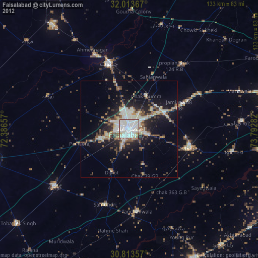
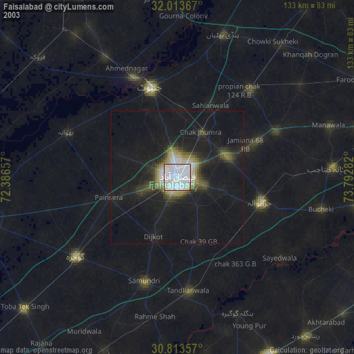
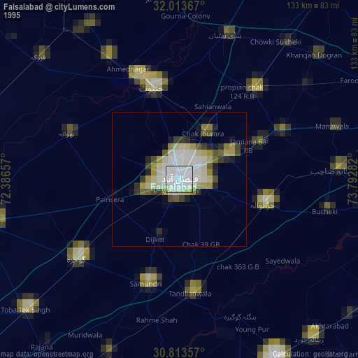
Faisalabad night lights from space
Night Light of Faisalabad (Punjab) from space (Pakistan) Src. Average luminocity for 10x10km area is 92.3776% and for 50x50km: 19.1863%.
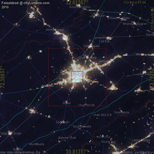
Analysis of Faisalabad night lights 2016
Square area 10x10 km:
 29.55%
90-99
54.37%80-89
5.07%70-79
0.52%60-69
1.57%50-59
6.12%40-49
1.92%30-39
0.87%20-29
0%10-19
0%0-9
0%Square area 50x50 km:
2.12%90-99
5.97%80-89
1.45%70-79
1.48%60-69
1.72%50-59
2.91%40-49
3.39%30-39
3.42%20-29
5.45%10-19
9.83%0-9
62.26%Clear (daylight) street map image can be seen on geolist.org.
Map coordinates:
32° 0' 49.2" North, 72° 23' 11.7" East
31° 24' 55.9" North, 73° 5' 22.9" East
30° 48' 48.9" North, 73° 47' 34.2" East
Some cities around Faisalabad sort by population:
• Chiniot
35.6 km =22.1 mi,  342°
342°
• Shahkot
41.3 km =25.7 mi,  65°
65°
• Jaranwala
32.5 km =20.2 mi,  106°
106°
• Chenab Nagar
41.3 km =25.7 mi, 336°
• Tandlianwala
42.7 km =26.5 mi,  174°
174°
• Chak Jhumra
19.1 km =11.9 mi,  27°
27°
• Khurrianwala
19.3 km =12 mi,  61°
61°
• Dijkot
23.8 km =14.8 mi,  201°
201°
1179400 (p: 2,506,595)
Sources (retrieved 2019-11-25):
» NASA, Earths city lights 1995
» NASA city lights 2003
» Earth at Night: Flat Maps 2012, 2016