Chak Jhumra night lights from space
Night Light of Chak Jhumra (Punjab) from space (Pakistan) Src. Average luminocity for 10x10km area is 17.8287% and for 50x50km: 21.7255%.

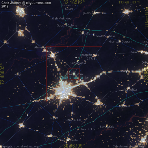
Analysis of Chak Jhumra night lights 2016
Square area 10x10 km:
 0.52%
0.52%90-99
1.57%80-89
0%70-79
0.7%60-69
1.4%50-59
4.55%40-49
4.72%30-39
6.29%20-29
8.74%10-19
24.13%0-9
47.38%Square area 50x50 km:
2.43%90-99
6.78%80-89
1.75%70-79
1.69%60-69
1.99%50-59
3.12%40-49
3.59%30-39
3.64%20-29
5.52%10-19
12.87%0-9
56.63%Clear (daylight) street map image can be seen on geolist.org.
Map coordinates:
32° 9' 54.8" North, 72° 28' 48.2" East
31° 34' 5.1" North, 73° 10' 59.4" East
30° 58' 1.5" North, 73° 53' 10.7" East
Some cities around Chak Jhumra sort by population:
• Faisalabad
19.1 km =11.9 mi,  207°
207°
• Chiniot
25.8 km =16 mi,  311°
311°
• Shahkot
28.6 km =17.8 mi,  89°
89°
• Jaranwala
34.4 km =21.4 mi,  139°
139°
• Chenab Nagar
32.9 km =20.4 mi, 309°
• Sangla Hill
25.1 km =15.6 mi,  48°
48°
• Khurrianwala
11.1 km =6.9 mi,  133°
133°
• Pindi Bhattian
37.7 km =23.4 mi,  13°
13°
1175748 (p: 37,214)
Sources (retrieved 2019-11-25):
» Earth at Night: Flat Maps 2012, 2016