Khanpur Mahar night lights from space
Night Light of Khanpur Mahar (Sindh) from space (Pakistan) Src. Average luminocity for 10x10km area is 3.3788% and for 50x50km: 5.1006%.
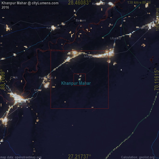
Analysis of Khanpur Mahar night lights 2016
Square area 10x10 km:
 0%
0%90-99
0.76%80-89
0%70-79
0%60-69
0.76%50-59
1.52%40-49
1.7%30-39
0.57%20-29
0%10-19
0%0-9
94.7%Square area 50x50 km:
0.48%90-99
0.9%80-89
0.27%70-79
0.43%60-69
0.73%50-59
0.76%40-49
1.5%30-39
0.93%20-29
1.07%10-19
4.06%0-9
88.87%Clear (daylight) street map image can be seen on geolist.org.
Map coordinates:
28° 27' 39" North, 68° 42' 35.6" East
27° 50' 27.2" North, 69° 24' 46.9" East
27° 13' 2.5" North, 70° 6' 58.1" East
Some cities around Khanpur Mahar sort by population:
• Kandhkot
50.5 km =31.4 mi,  333°
333°
• Pano Aqil
29.7 km =18.5 mi,  273°
273°
• Ghotki
20.5 km =12.7 mi, 332°
• Mirpur Mathelo
24.1 km =15 mi,  33°
33°
• Khairpur
37.8 km =23.5 mi,  48°
48°
• Ghauspur
46.4 km =28.8 mi,  315°
315°
• Ubauro
47.6 km =29.6 mi,  40°
40°
• Adilpur
14.1 km =8.8 mi, 319°
1174171 (p: 22,273)
Sources (retrieved 2019-11-25):
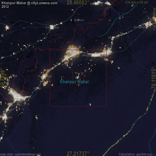
» Earth at Night: Flat Maps 2012, 2016