Tanza night lights from space
Night Light of Tanza (Metro Manila) from space (Philippines) Src. Average luminocity for 10x10km area is 62.4029% and for 50x50km: 40.5843%.
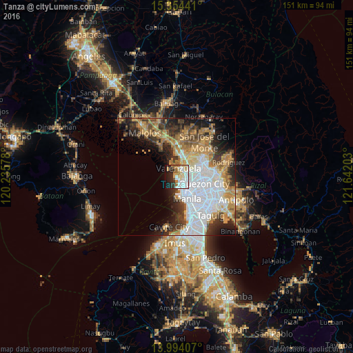
Analysis of Tanza night lights 2016
Square area 10x10 km:
 20.04%
90-99
15.29%80-89
9.09%70-79
7.02%60-69
9.09%50-59
0.62%40-49
1.24%30-39
5.58%20-29
14.46%10-19
16.32%0-9
1.24%Square area 50x50 km:
13.18%90-99
6.69%80-89
3.59%70-79
6.81%60-69
6.89%50-59
3.03%40-49
3.59%30-39
5.17%20-29
6.85%10-19
8.61%0-9
35.6%Clear (daylight) street map image can be seen on geolist.org.
Map coordinates:
15° 21' 15.9" North, 120° 14' 8.8" East
14° 40' 31.1" North, 120° 56' 20" East
13° 59' 38.7" North, 121° 38' 31.3" East
Some cities around Tanza sort by population:
• Manila
9.2 km =5.7 mi,  149°
149°
• Caloocan City
4.2 km =2.6 mi,  132°
132°
• Navotas
1.5 km =0.9 mi, 128°
• Meycauayan
7.2 km =4.5 mi,  18°
18°
• Marilao
9.2 km =5.7 mi,  6°
6°
• Obando
3.8 km =2.4 mi,  355°
355°
• Quiapo
9.6 km =6 mi, 150°
• Del Monte
9.3 km =5.8 mi,  113°
113°
1683013 (p: 105,510)
Sources (retrieved 2019-11-25):
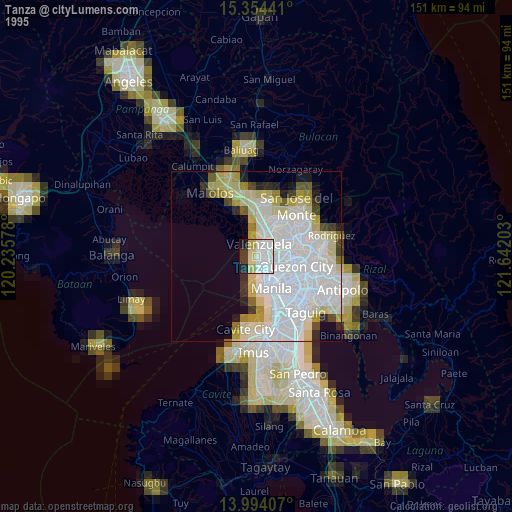
» NASA, Earths city lights 1995
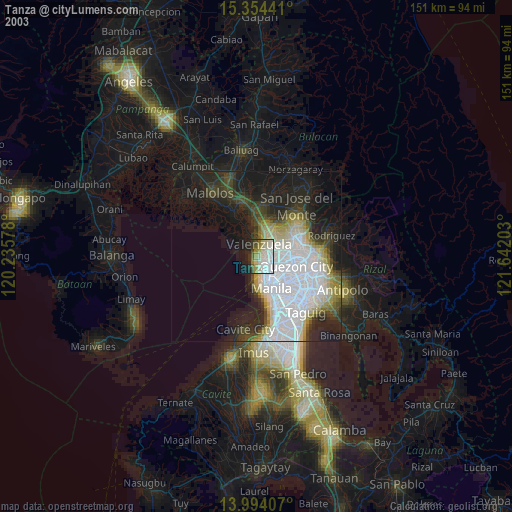
» NASA city lights 2003
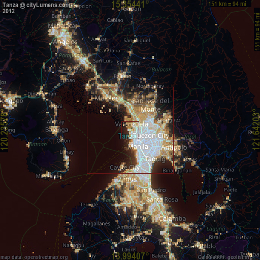
» Earth at Night: Flat Maps 2012, 2016