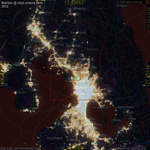
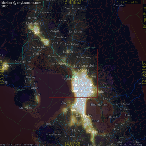
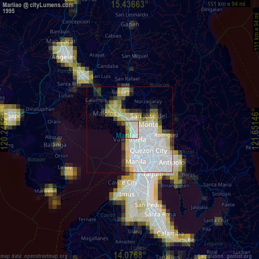
Marilao night lights from space
Night Light of Marilao (Central Luzon) from space (Philippines) Src. Average luminocity for 10x10km area is 64.5165% and for 50x50km: 37.3726%.

Analysis of Marilao night lights 2016
Square area 10x10 km:
 5.37%
5.37%90-99
10.12%80-89
14.46%70-79
18.39%60-69
21.49%50-59
4.96%40-49
2.27%30-39
7.85%20-29
12.6%10-19
2.48%0-9
0%Square area 50x50 km:
10.76%90-99
5.48%80-89
3.36%70-79
7.1%60-69
6.85%50-59
3.21%40-49
3.89%30-39
4.54%20-29
6.53%10-19
10.9%0-9
37.36%Clear (daylight) street map image can be seen on geolist.org.
Map coordinates:
15° 26' 11.9" North, 120° 14' 42.8" East
14° 45' 28" North, 120° 56' 54" East
14° 4' 36.5" North, 121° 39' 5.3" East
Some cities around Marilao sort by population:
• Meycauayan
2.7 km =1.7 mi,  149°
149°
• Tanza
9.2 km =5.7 mi,  186°
186°
• Bocaue
5.1 km =3.2 mi,  332°
332°
• Bulacan
8.4 km =5.2 mi,  297°
297°
• Obando
5.5 km =3.4 mi, 193°
• Loma de Gato
6.4 km =4 mi,  57°
57°
• Lambakin
8.8 km =5.5 mi,  264°
264°
• Sulucan
4.7 km =2.9 mi, 329°
1700917 (p: 83,276)
Sources (retrieved 2019-11-25):
» NASA, Earths city lights 1995
» NASA city lights 2003
» Earth at Night: Flat Maps 2012, 2016