Obando night lights from space
Night Light of Obando (Central Luzon) from space (Philippines) Src. Average luminocity for 10x10km area is 57.1777% and for 50x50km: 39.2907%.
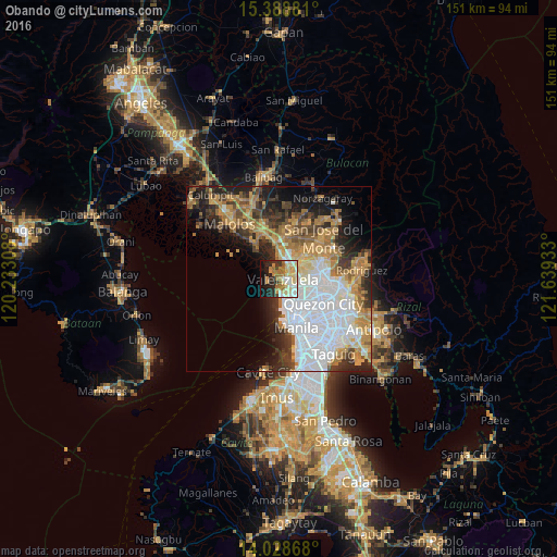

Analysis of Obando night lights 2016
Square area 10x10 km:
 7.64%
7.64%90-99
11.78%80-89
12.81%70-79
11.78%60-69
13.64%50-59
2.27%40-49
1.03%30-39
6.61%20-29
13.43%10-19
17.77%0-9
1.24%Square area 50x50 km:
12.32%90-99
5.99%80-89
3.43%70-79
6.94%60-69
7.01%50-59
3.09%40-49
3.82%30-39
5.15%20-29
6.8%10-19
8.83%0-9
36.62%Clear (daylight) street map image can be seen on geolist.org.
Map coordinates:
15° 23' 19.7" North, 120° 13' 59.1" East
14° 42' 35.3" North, 120° 56' 10.3" East
14° 1' 43.2" North, 121° 38' 21.6" East
Some cities around Obando sort by population:
• Caloocan City
7.5 km =4.7 mi,  153°
153°
• Navotas
5 km =3.1 mi,  162°
162°
• Meycauayan
4 km =2.5 mi,  41°
41°
• Tanza
3.8 km =2.4 mi,  175°
175°
• Bocaue
9.9 km =6.2 mi,  353°
353°
• Marilao
5.5 km =3.4 mi,  13°
13°
• Lambakin
8.7 km =5.4 mi,  300°
300°
• Sulucan
9.5 km =5.9 mi, 353°
1697376 (p: 59,929)
Sources (retrieved 2019-11-25):
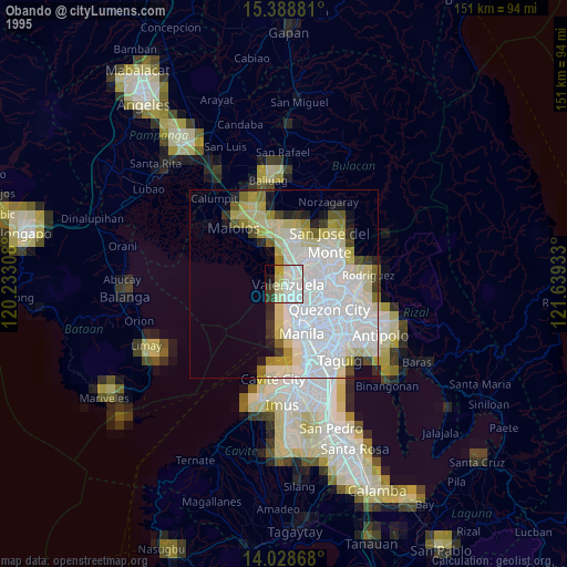
» NASA, Earths city lights 1995
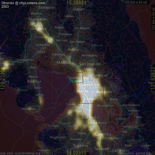
» NASA city lights 2003
» Earth at Night: Flat Maps 2012, 2016